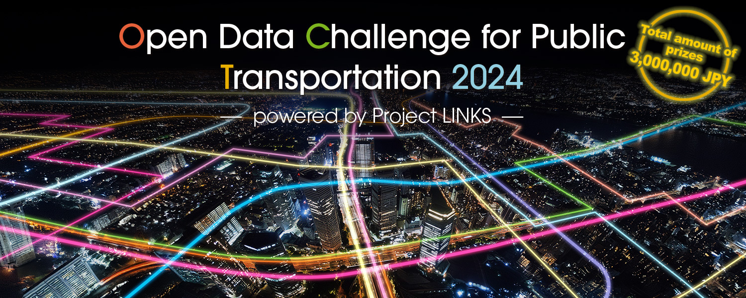
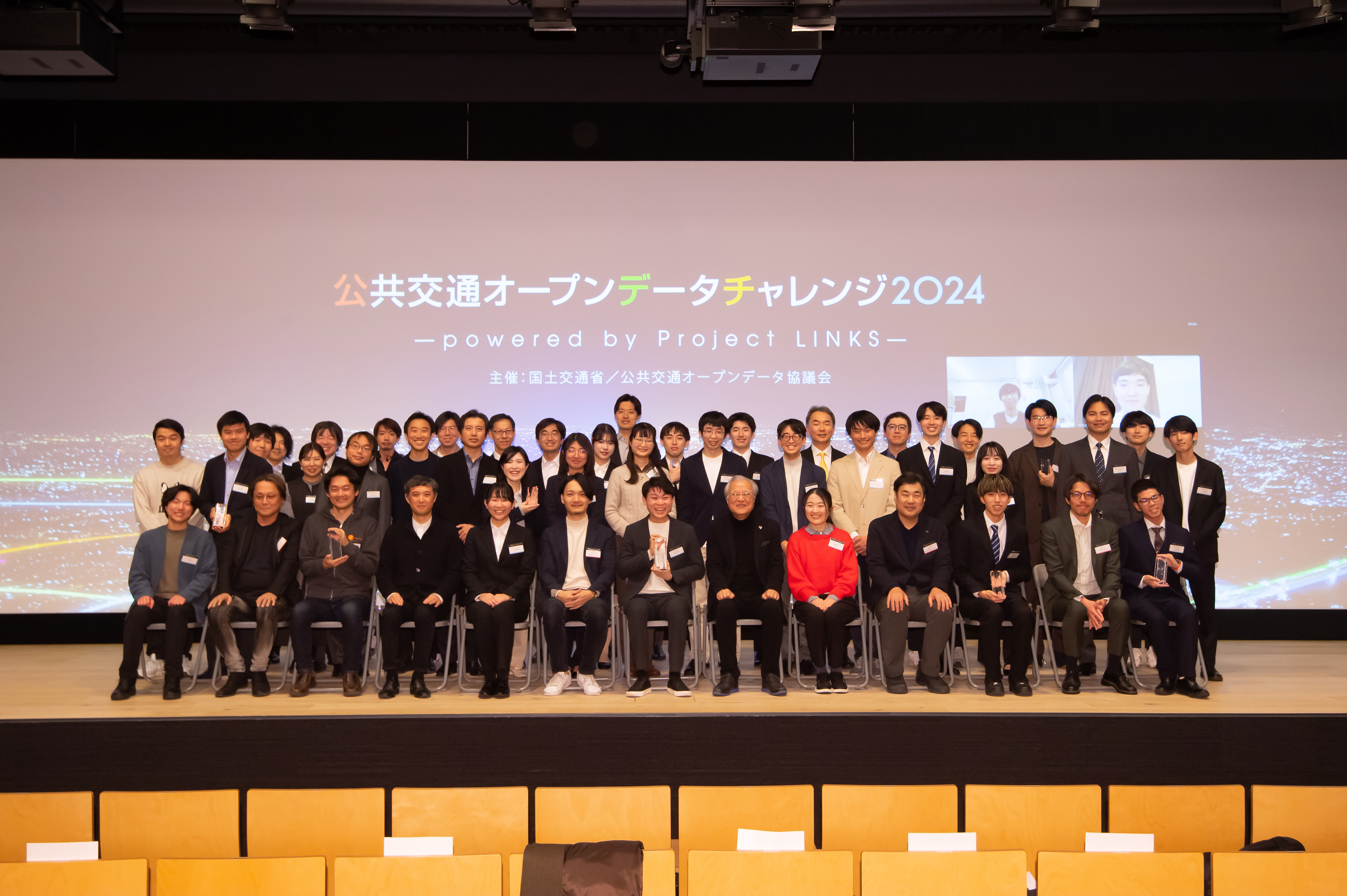
The final judging meeting and awards ceremony for the "Open Data Challenge for Public Transportation 2024 - powered by Project LINKS -" was held on February 15, 2025.
The 17 finalists, carefully selected from among the many entries from Japan and overseas, presented their submissions, which made full use of brilliant ideas and technical skills.
We are pleased to announce the wonderful submissions that won the awards, after the judges had a hard time selecting. You can view or download them by clicking on the name of each work. Please check them out.
Ken Sakamura
Chair, Association for Open Data of Public Transportation
Professor Emeritus, the University of Tokyo
Head of collaboration Hub for University and Business (cHUB), Faculty of Information Networking for Innovation And Design (INIAD), Toyo University
Association for Open Data of Public Transportation (ODPT) consists of many public transportation operators, regional governments, ICT stakeholders, and academic research institutions such as universities. Since its inception in 2015, it has been striving to achieve more open distribution of public transportation data in Japan, focusing on the fields of railways, buses, ferries, airlines and shared bicycles.
The Open Data Challenge for Public Transportation is an application contest that started as an "Incentive Prize Competition." This was the fifth contest, as similar contests targeting Tokyo have been held four times in total for the Tokyo Olympics and Paralympics. We issued a public call to general developers for applications that utilize data such as timetables and real-time operation status, which was made available by public transportation operators.
The "Incentive Prize Competition" sets clear goals and prize money for solving specific problems, and encourages a wide range of participants to submit their works. This approach promotes the creation of diverse ideas that are difficult to generate through conventional research and development activity, and nurtures the aggregation of a wide range of specialized knowledge. As a result, this approach has achieved significant innovation in many fields, from private spaceship development to the evolution of autonomous driving technology.
There are two major new features to this year's "Open Data Challenge for Public Transportation 2024 - powered by Project LINKS -." First of all, "Tokyo" was removed from the contest name, and the contest became the one that covers all of Japan. Secondly, this contest was a tie-up with the Ministry of Land, Infrastructure, Transport and Tourism's Project LINKS. As a result, we were able to obtain the cooperation of 25 railway operators, 71 bus operators, 226 community bus operators, 23 ferry operators, 5 airlines and airport-related companies, and 2 shared bicycle operators, making this the largest public transportation-related contest to date. There were approximately 500 entries from Japan and overseas, and 17 finalists were selected at the initial screening, and the winning submissions were decided after the final judging meeting.
The ODPT has reached its 10-year milestone since its inception in 2025. In the meantime, the Public Transportation Open Data Center we set up has grown into a data platform used by many transportation operators, ICT stakeholders and developers. By making public transportation data available, it can be used in transit information services, and new applications can be developed through a variety of creative ideas and combinations with different data. This time, too, a variety of attractive ideas were born. We believe that the significance of the Open Data Challenge for Public Transportation is that it allows us to explore the possibilities of open innovation together.
We would like to express our sincere gratitude to all the developers who participated in this challenge, the transportation operators and regional governments that provided data, and many people who support our activities as always. Thank you all for your continuing support.
Yuya Uchiyama
Director for New Mobility Service Division, Policy Bureau
Technical Director, Project LINKS
PLATEAU ADVOCATE 2024
Part-time Lecturer, the Graduate School of Engineering and Faculty of Engineering, the University of Tokyo
Cooperating Researcher, the Center for Spatial Information Science, the University of Tokyo
Thank you for participating in the "Open Data Challenge for Public Transportation 2024 - powered by Project LINKS -."
We received many applications, and I came into contact with new ideas and wonderful technology, which was a great learning experience and very stimulating for me. Thank you very much.
We are able to realize such a challenging initiative thanks to the cooperation of all the operators that provide data because they share our philosophy of promoting open data and creating innovation in the world of public transportation.
We would like to take this opportunity to thank all the businesses that provided GTFS and other data openly.
This time's "Challenge" was held in collaboration with the "Project LINKS" being promoted by the MLIT, and was organized jointly by the MLIT and ODPT.
Project LINKS is an initiative to promote the "digitization" of various information in the field of land, infrastructure, transport and tourism, and the creation of open innovation using this information.
In this "Challenge," not only GTFS and other various transportation data, but also the data related to urban planning and various statistical data were actively utilized, and I saw the birth of new value from the data in the field of land, infrastructure, transport and tourism.
In addition, many of the submissions themselves not only presented solutions to improve transportation convenience, but also addressed issues in Japan today, such as eliminating "transport poverty," improving business productivity, and collaborating with town planning, and offered solutions, full of policy implications.
The MLIT will continue to promote the development and use of standard data for transportation information such as GTFS. I hope that this "Challenge" will lead to further innovation.

Ken Sakamura
Chair, Association for Open Data of Public Transportation
Professor Emeritus, the University of Tokyo
Head of collaboration Hub for University and Business (cHUB), Faculty of Information Networking for Innovation And Design (INIAD), Toyo University
The "Open Data Challenge for Public Transportation 2024 - powered by Project LINKS -" is the fifth contest we have hosted. We received many great submissions in more numbers than we had expected, so we decided to set up the Super Excellence Awards at the final judging meeting on the day.
Based on the conclusion of a fair judge meeting, the Grand Award was given to "Cycle-Shortcut: Beat the Winding Rails" by Nishikata Tokotoko Explorers. It combines the data related to railways and shared bicycle published by the Public Transportation Open Data Center, as well as the transportation census data, to help users find the best route for using a bicycle rather than a train. In addition to having a clear problem setting, this submission was excellent in terms of the combination of open data, so it won the Grand Award.
The two submissions that received the Super Excellence Awards are "PoiCle," which uses GTFS real-time data to notify users when they are approaching a specific location such as a train station or bus stop, and "RailroadCrossFree," which uses train location data to estimate and visualize the probability of an automobile being stopped at a railroad crossing. I think both of these are excellent works that propose new ways of using real-time data.
In addition, four works were selected for the Excellence Awards: "Public transportation analysis tool - SPECTRA PROJECT," "GTFS box," "Sumilog" and "Metro Finder." The Judge's Special Awards were given to "Annelida," "Online announcement data management 'AOI system'," "CALOCULATE" and "Stop here?" as the works that each judge particularly liked.
In this challenge, I saw a lot of new submissions from the developers who had also participated in past challenges, as well as works from young students, and I felt the emergence of a young community supporting public transportation open data. We hope that this challenge expands the new uses of public transportation open data, and helps create a better society for both public transportation users and operators.

Yuya Uchiyama
Director for New Mobility Service Division, Policy Bureau
Technical Director, Project LINKS
PLATEAU ADVOCATE 2024
Part-time Lecturer, the Graduate School of Engineering and Faculty of Engineering, the University of Tokyo
Cooperating Researcher, the Center for Spatial Information Science, the University of Tokyo
In this challenge, there were so many excellent works that it was very difficult to judge. From the perspective of the Ministry of Land, Infrastructure, Transport and Tourism, which is promoting the use of open data in the public transportation sector and creating innovations to solve issues in regional transportation and urban planning, I paid particular attention to the following three submissions.
"Online announcement data management 'AOI System'," which was selected for one of the Judge's Special Awards, is a cloud-based audio guidance system for buses using GTFS. In response to the current issues of the complexity of in-vehicle bus systems and modernization, it has achieved new value creation through simplification and the use of ads. In addition, it provides a no-code management tool and automated voice generation, realizing a very advanced solution, so I have high expectations for its future development.
Next, we selected "SPECTRA PROJECT" and "OcRail" for the "Project LINKS Award."
"SPECTRA PROJECT" is a tool that visualizes various statistical information aside from GTFS and GBFS on a WebGIS, and what is particularly noteworthy is its light weight and UX. I felt that this submission, which can be used to introduce data utilization without stress, assuming users such as regional government office staff who are not familiar with IT, is exactly the kind of solution that is needed for regional transportation today.
"OcRail" utilizes the freight train data in GTFS format provided by Project LINKS in collaboration with Japan Freight Railway Company. In addition to their efforts to visualize data, they also contributed to improving data quality through feedback on the data specification.
I also learned many other excellent works, including the "Station Area Database Map" and "Annelida."
In these cases, I am now focusing on the fusion of implementation skill and UX. The wide use of OSS and large-scale language models has lowered the hurdle to "just making something that works," but the technical competition of making "something that can really be used" has increased. In this challenge, I felt the high level of technical skill in the world of public transportation.
The catchphrase of this challenge was "Innovation through public transportation open data." The Ministry of Land, Infrastructure, Transport and Tourism will continue to expand open data and improve the environment for creating innovation.
I look forward to your continued challenges.

Kenichi Ito
MaaS Division / Strategies & Business Platform Department, Marketing Headquarters, East Japan Railway Company
Public transportation is an important social infrastructure that supports the cultural and economic activity of local residents and visitors to the area, as well as a variety of other activities. You may choose the most efficient mobility from a variety of options and move around efficiently, or you may spend a relaxing time listening to music or watching videos while you are on the move. Regardless of nationality, modern people have a close relationship with mobility.
This year's "Open Data Challenge for Public Transportation 2024 - powered by Project LINKS -̶," presented wonderful ideas and business seeds that add value to everyday life as submissions, reflecting the relationship between people today and mobility. Of these, "CALOCULATE," "Marugame City Bus Stop SNS Web App 'Bus Kame Fan!'," and "Reachable (in Tokyo)" were based on the main focus of the contest, the use of data. Additionally, they started from "everyday problems" and created solutions and added value by adding new enjoyment to everyday life and movement. I am very happy to see that, while understanding and making use of the latest technology, the contestants were demonstrating creativity that is unique to humans, which could be called "learning from the past to create the future."
I would like to express my gratitude to all the applicants who have made use of various data, including transportation data, to realize a wide variety of ideas through the past Open Data Challenges for Public Transportation. Also, I pray that the various social issues that will become increasingly apparent in the future will be solved with the wisdom of the participants in this challenge, that a new world will be opened up, and that our future will become more prosperous.
Yuji Yoshimura
Project Associate Professor, Research Center for Advanced Science and Technology, the University of Tokyo
I was involved in the judging for the "Open Data Challenge for Public Transportation 2024 - powered by Project LINKS -" for the first time. I had heard in advance that this was a "hackathon using public transportation data," so I thought there would be a lot of proposals in the transportation field, but when I was at the judging meeting, I was surprised to find that there were a lot of proposals in the urban planning and community development fields.
The Grand Award-winning submission "Cycle-Shortcut: Beat the Winding Rails" gives game-like enjoyment to the selection of the alternatives of traveling by train or bicycle, and "PoiCle" sensibly incorporates a way of enjoying the city by showing you where you can catch a glimpse of the sea from the train, etc. "Annelida" focuses on visualization technology that analyzes cities from a different perspective than that of shortest route searches, etc.
I was encouraged as a researcher specializing in urban planning and community development to see people from various fields make many proposals from a variety of angles while using transportation data as a reference.
Generally speaking, a city is a place where many people live. We have built cities in order to find joy in living together. And in such a densely populated area, a high quality of life with a rich cultural atmosphere is essential. The cities of the future, and the urban design of the future, should use data to improve the quality of citizens' lives, and I think that the key to this lies in optimizing data, as well as in the areas that fall outside of data optimization.
I think there were many proposals that could deepen such a viewpoint among the submissions this time. A perspective of building a town together, and growing a town together, with data at the core.
I would like to note that it was a judging meeting that made the judges excited.

Noritaka Shinohara
Val Laboratory Corporation
Executive Officer
MaaS Department. Producer
Thank you to everyone who participated in the "Open Data Challenge for Public Transportation 2024 - powered by Project LINKS -."
I was inspired by the various approaches that the contestants adopted to the challenge, whether it was to find existing or latent issues, or to achieve product/market fit as a future business.
From the perspective of route search, "Cycle-Shortcut: Beat the Winding Rails," "Metro Finder" and "Stop here?" are services that I can relate to in terms of usage situation, and that work on how to solve user issues in an easy-to-understand way. From the viewpoint of real-time data, "RailroadCrossFree" and "PoiCle" gave me ideas on how to make use of dynamic data "now."
On the other hand, "Online announcement data management 'AOI system'," which is already being promoted as business, is a promising example of the digitization (automation/dynamization) and commercialization of open data.
All of them contain attractive user values, and I feel that they should continue to develop in the future.
I think that success stories will lead the way in the future, so I look forward to seeing what you all do with the data and how you use it to create value and improve usability.
Thank you very much.

Masahiro Bessho
Professor of Faculty of Information Networking for Innovation And Design (INIAD), Toyo University
I was surprised by the high level of quality of the many entries we received for this challenge, both those that won prizes and those that were not selected. In the past four "Open Data Challenge for Public Transportation in Tokyo," there were some submissions that were still in the idea stage, but this time, the majority of the submissions were highly polished to details. I heard that ChatGPT and other generative AI have been actively used in application development, and I think that the development of such technology may have been behind the high level of completeness achieved this time. I hope that the use of public transportation data will continue to progress in line with future technological developments.
I think the real appeal of the Open Data Challenge is finding new ways to solve problems by "combining" different types of data. I think the combination of data on shared bicycles and trains in the Grand Award-winning "Cycle-Shortcut: Beat the Winding Rails" is a wonderful approach using the straightforward method. I also thought that the "notification of places where you can see the sea" that combines public transportation open data and elevation models in "PoiCle," one of the Super Excellence Awards winning submissions, was a great idea. There were also many other great ideas of "combinations," and I could feel the ingenuity of the developers.
In this challenge, a large amount of GTFS data, which are increasingly used worldwide, have been made public. With this background, I was impressed that the high-quality GTFS viewer "GTFS box" was released as open source. I personally hope strongly that future challenges will produce works that focus on supporting the mobility of challenged people. During the presentation of "RailroadCrossFree" at the final judging meeting, there was a comment about considering its development for use in pedestrian mobility support. Progress is being made in the open data of barrier-free information related to mobility, including data for spatial network for pedestrians. I hope that you will combine public transportation open data with these data to create a society where more people can move around more conveniently.