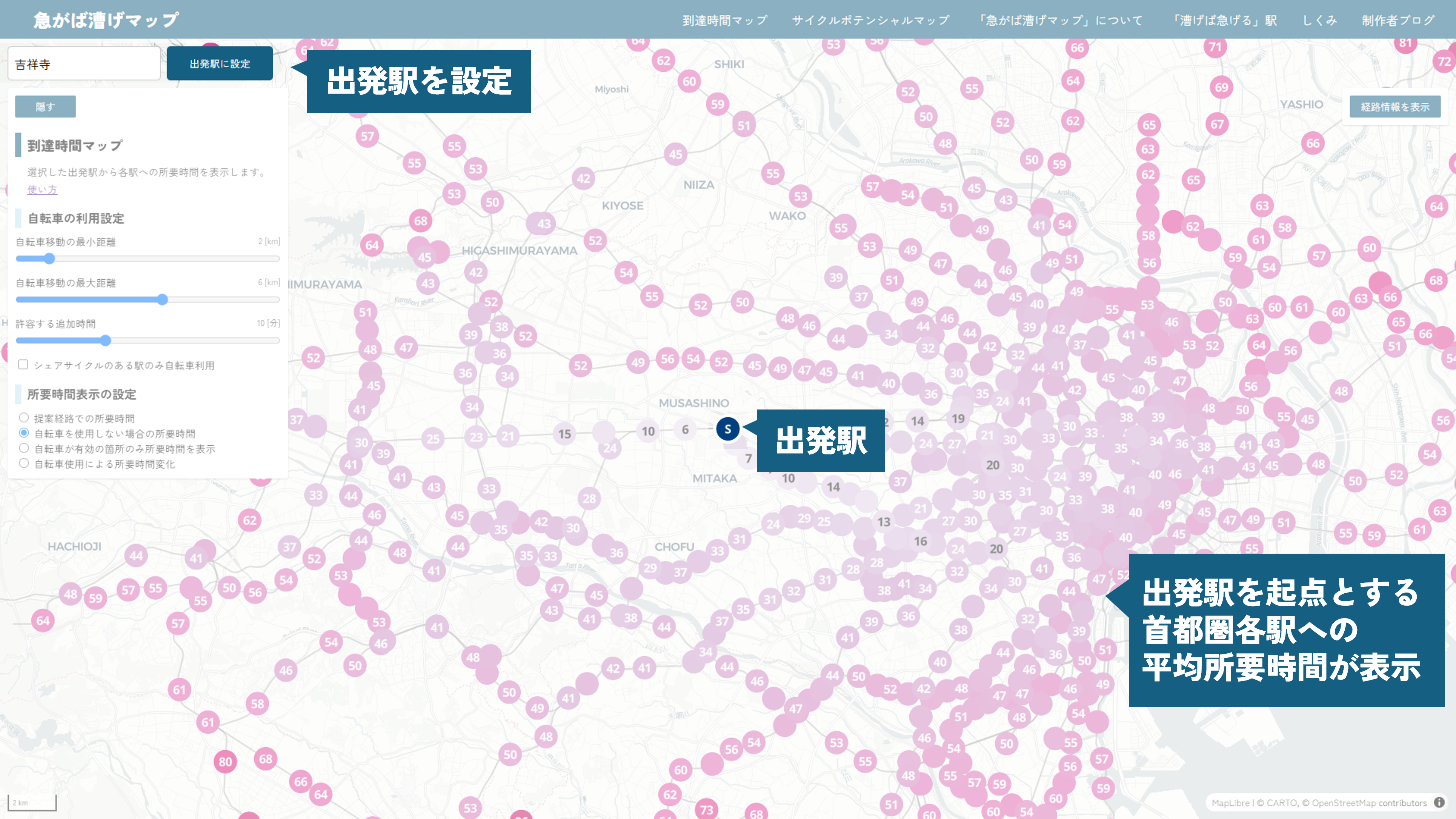
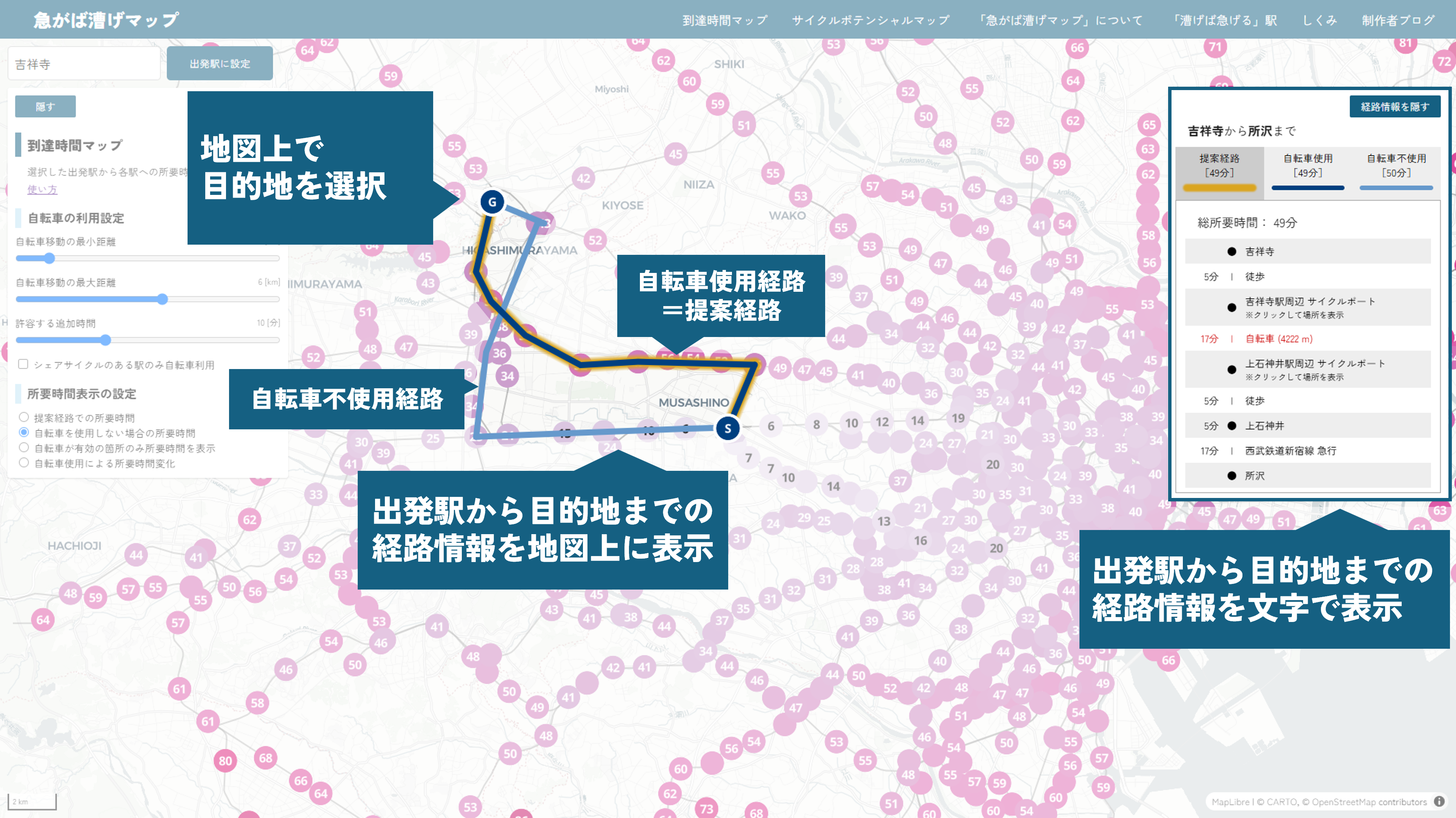
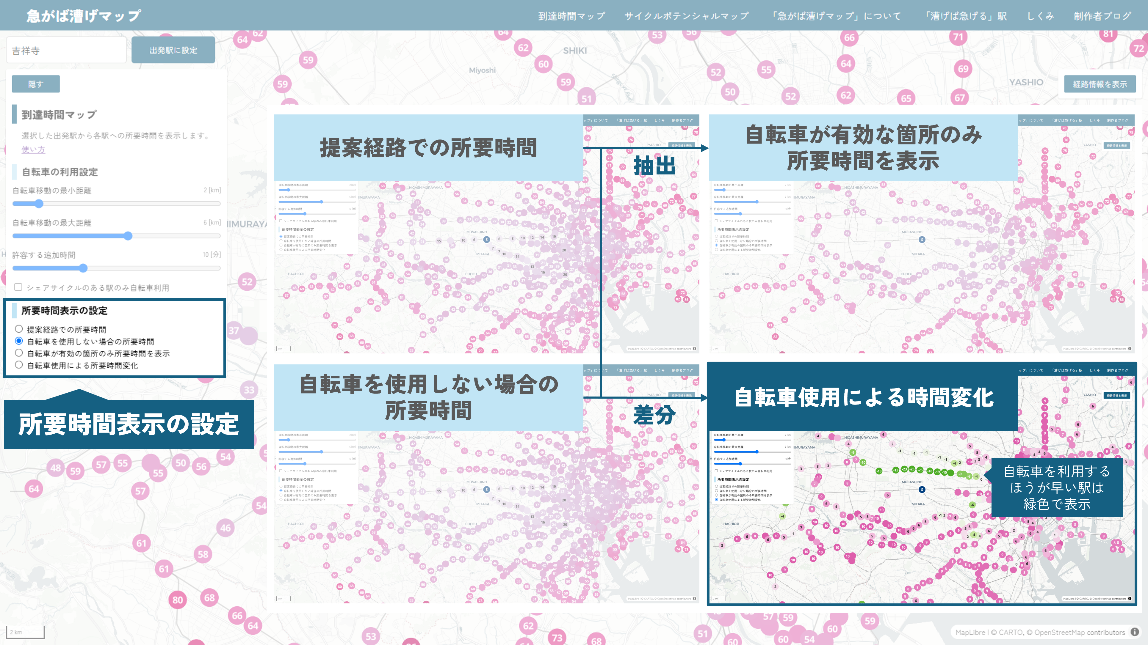
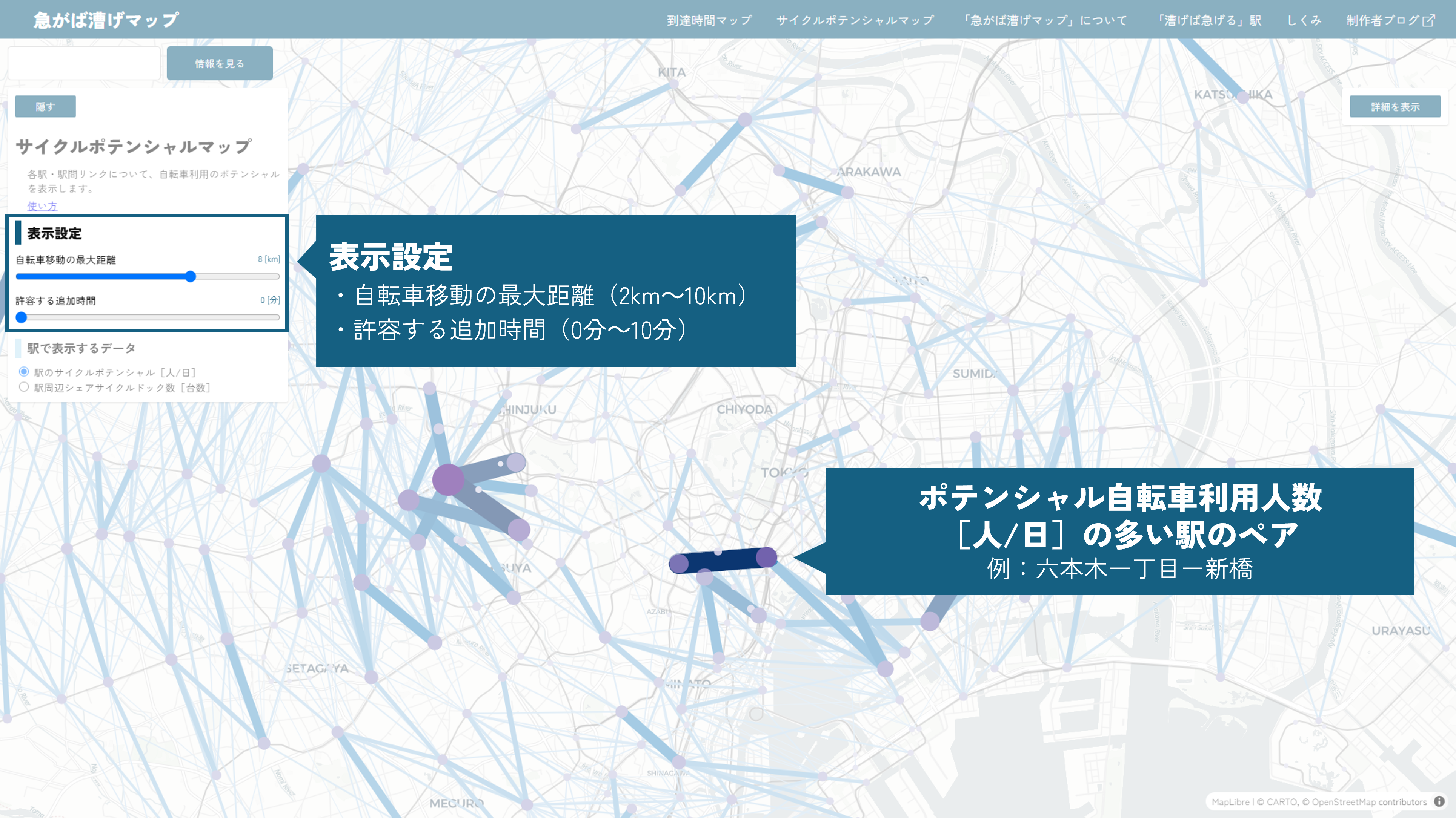
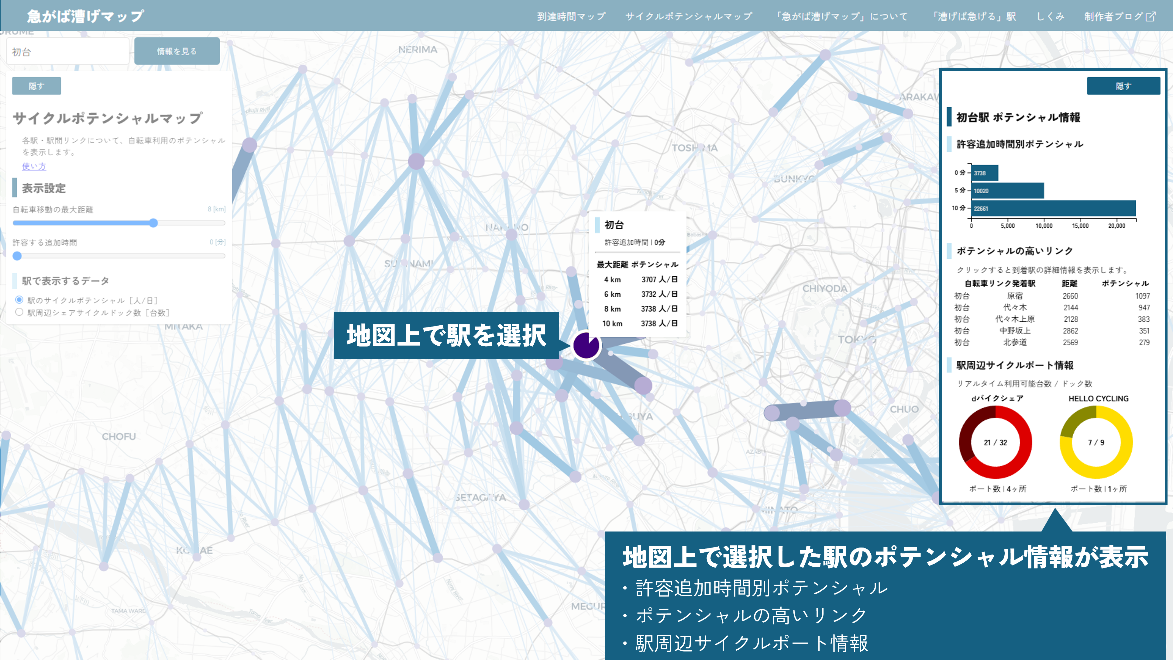
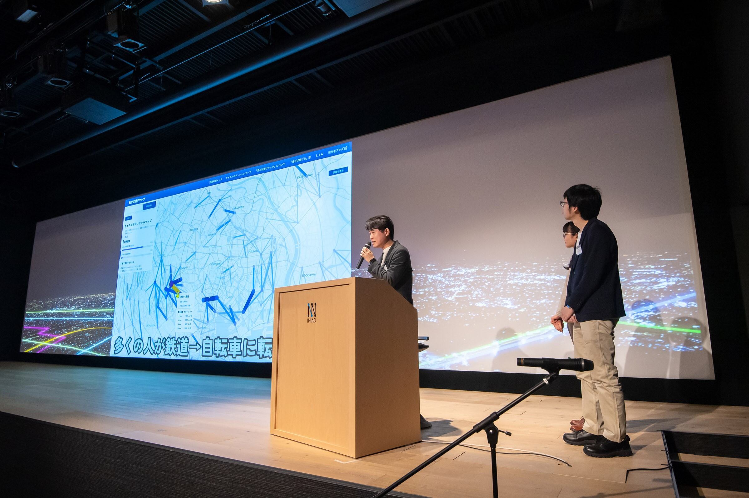
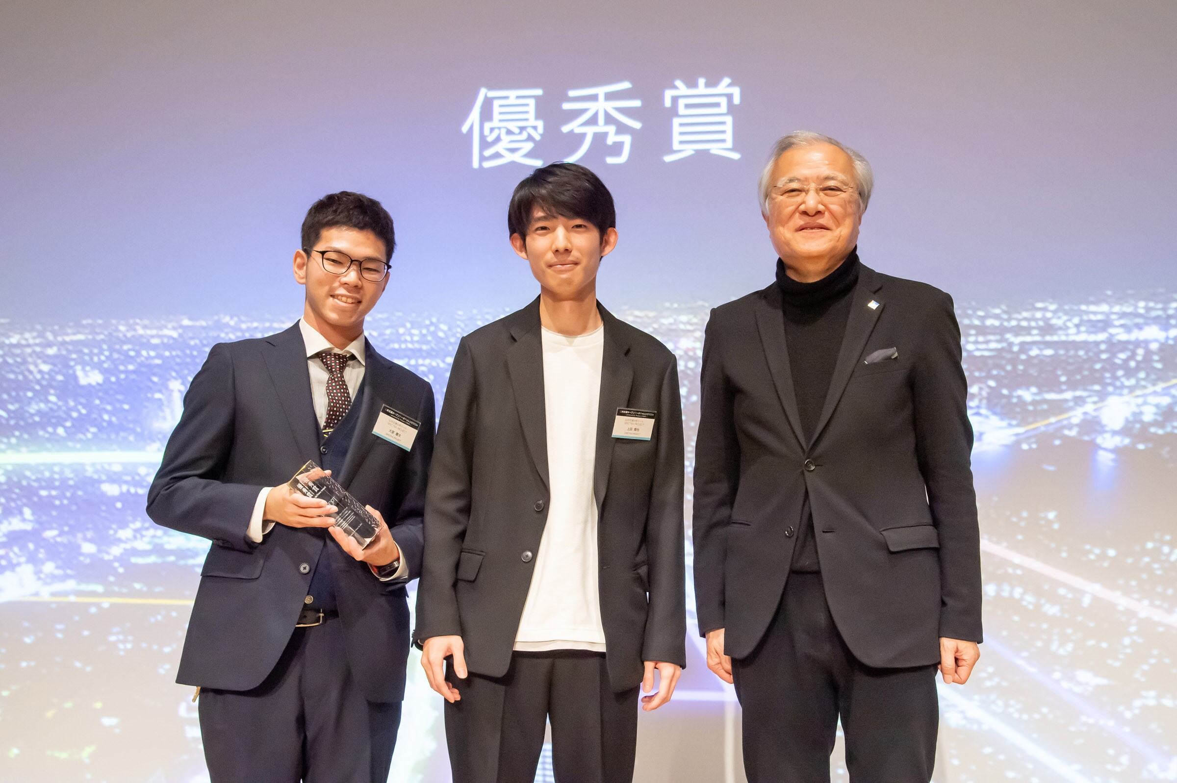
The "Cycle Shortcut: Beat the Winding Rails” reveals optimal routes by combining rail and shared cycles in Tokyo. It compares travel times with and without cycles allowing users to discover optimal paths, and identifies high-potential routes for municipalities and operators for marketing and policy planning.
Download
□web app
https://nishikata-tokotoko.github.io/cycle-shortcut-map/

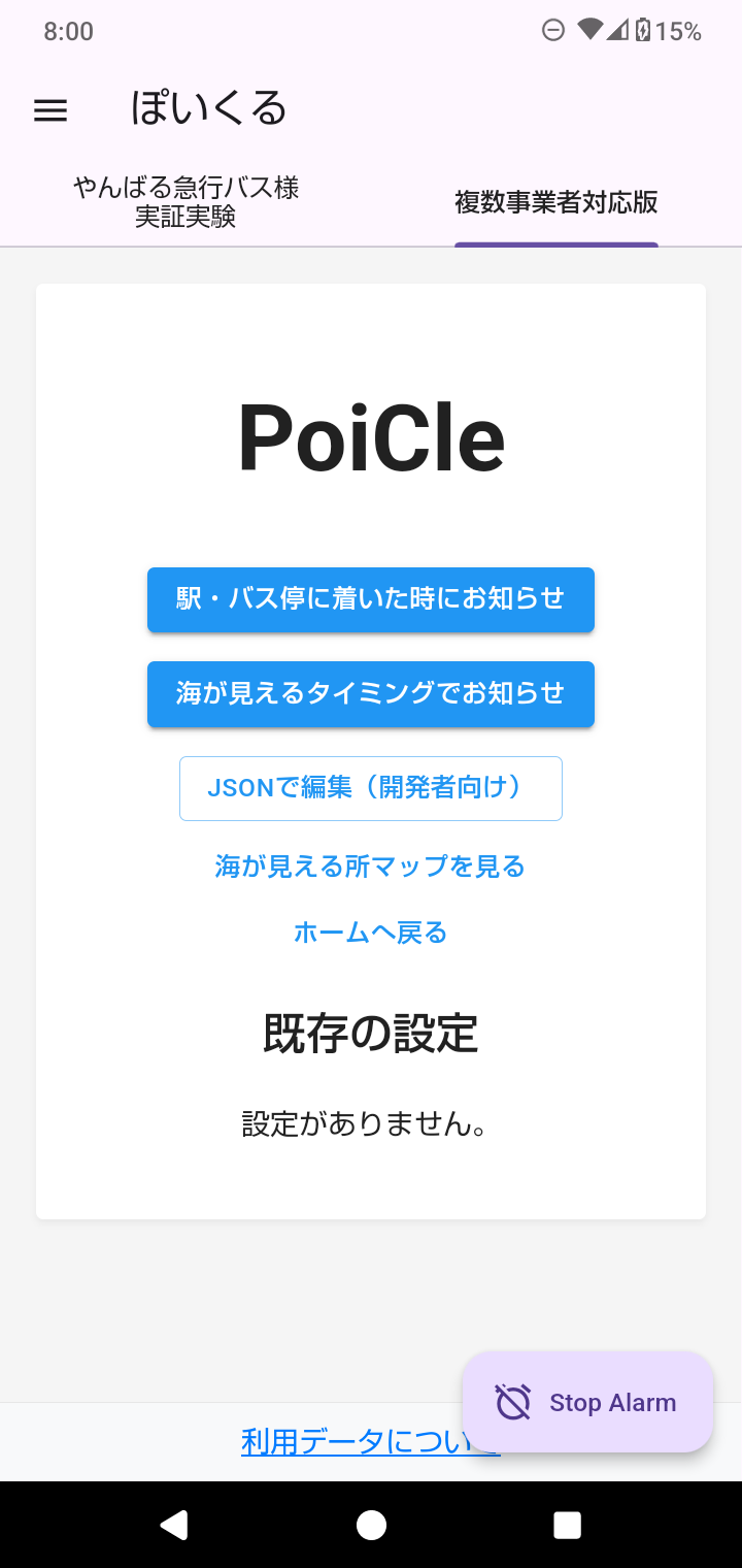
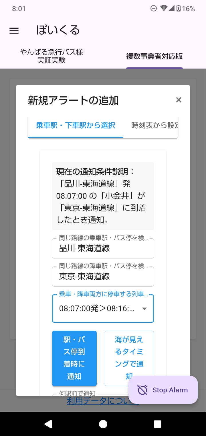
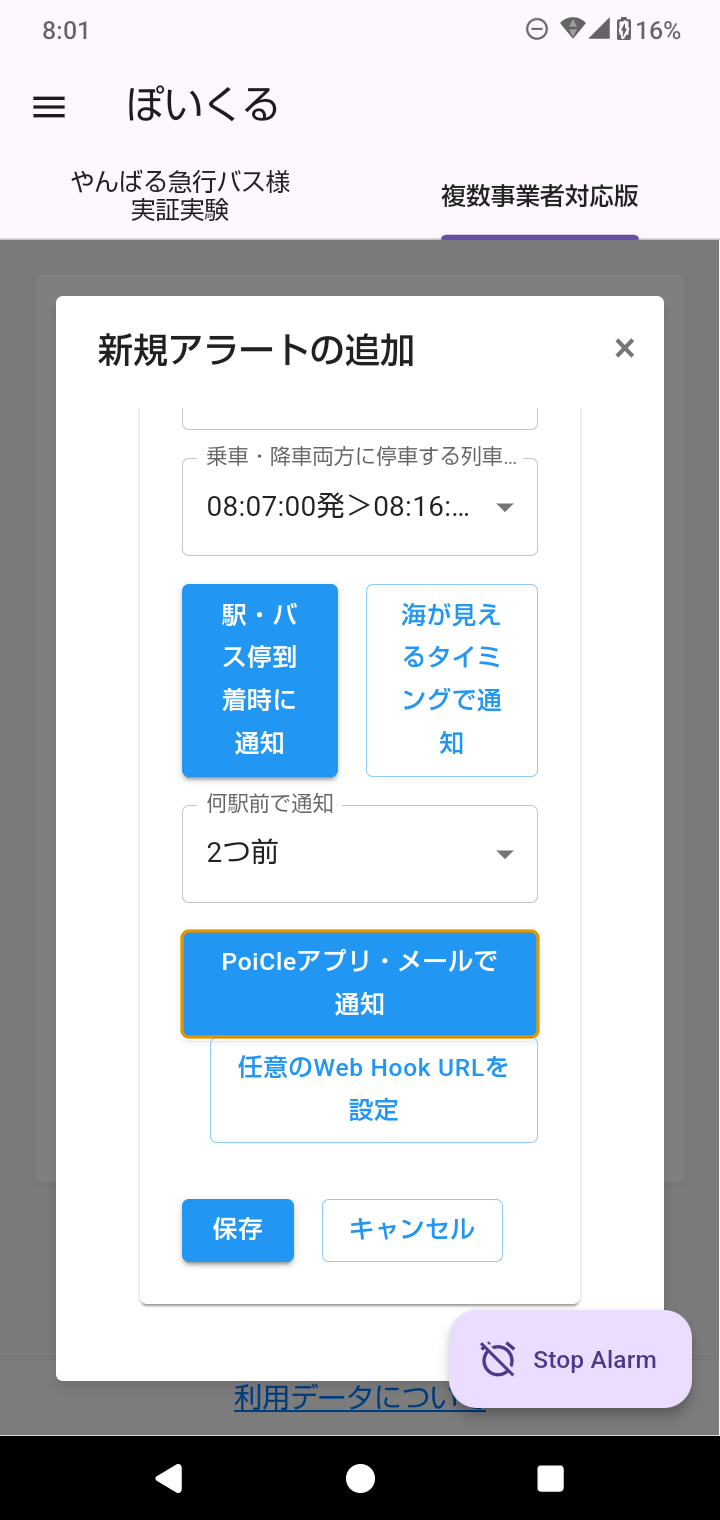
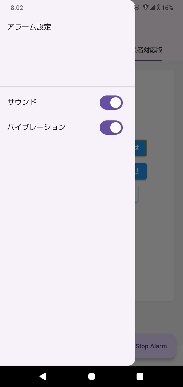
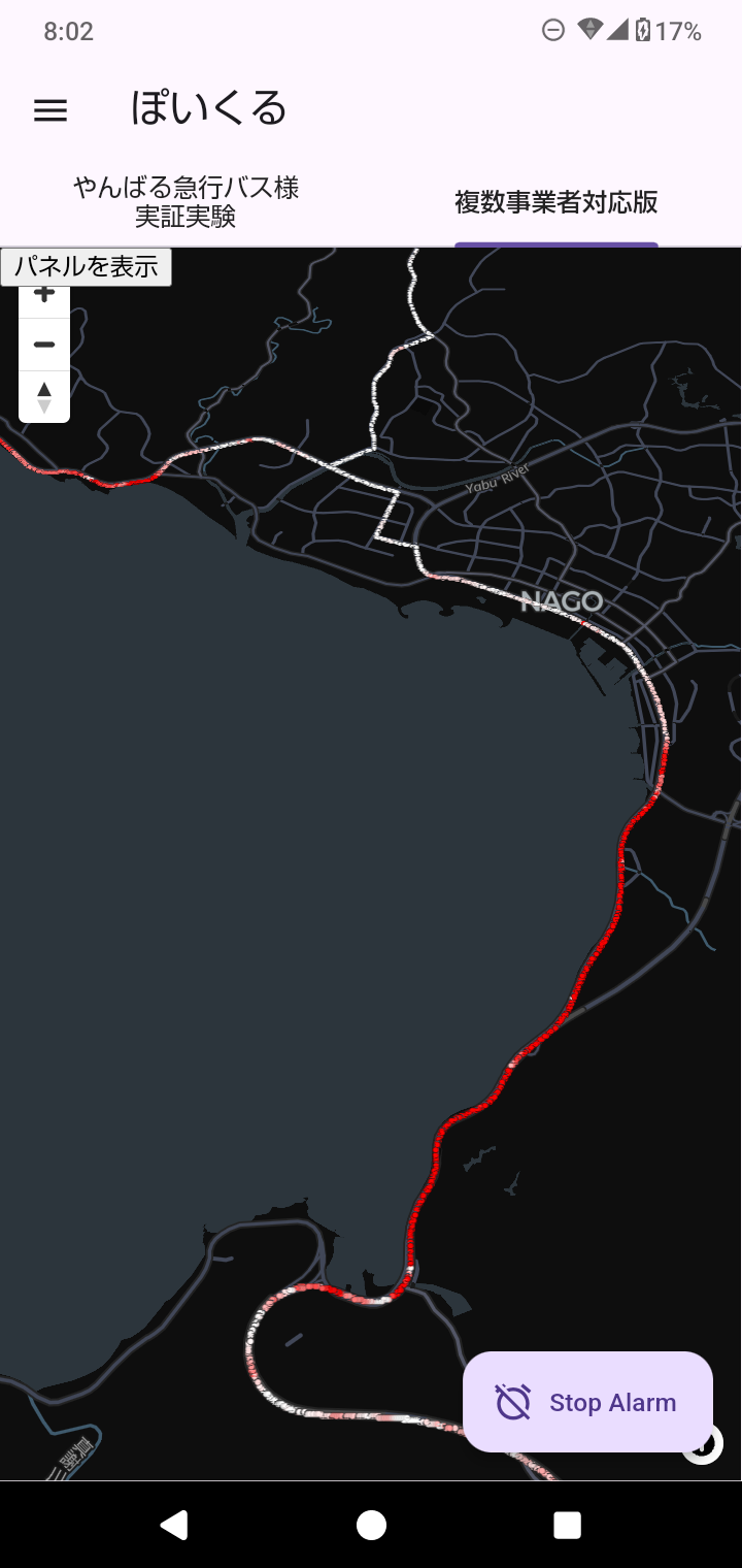
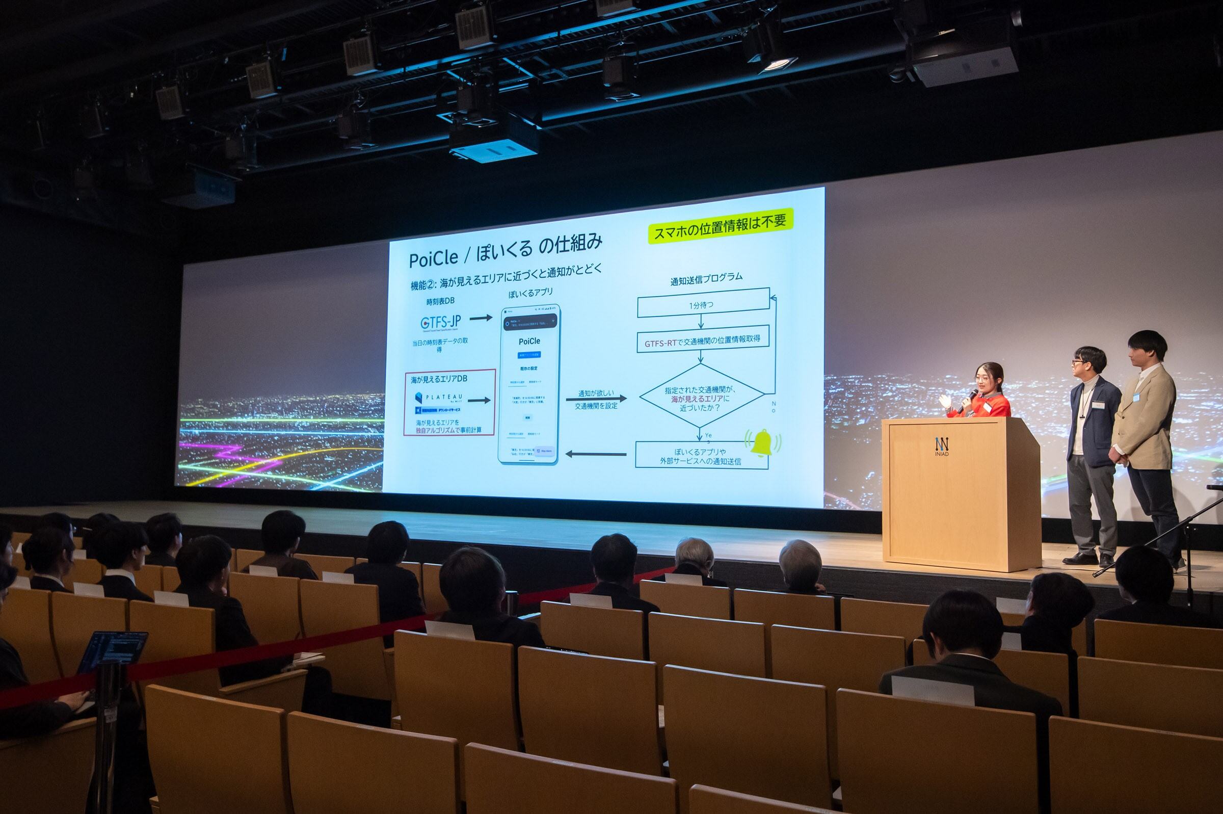
PoiCle is a GTFS-RT-based notification system that alerts users when a transport service approaches a station, stop, or specific location (POI) on a real-time basis. The app "PoiCle" offers two alarm features: one for station / stop approach notifications and another for notifications in areas with sea views.
Download
□Android app
https://play.google.com/store/apps/details?id=window_grapher.com.alarm

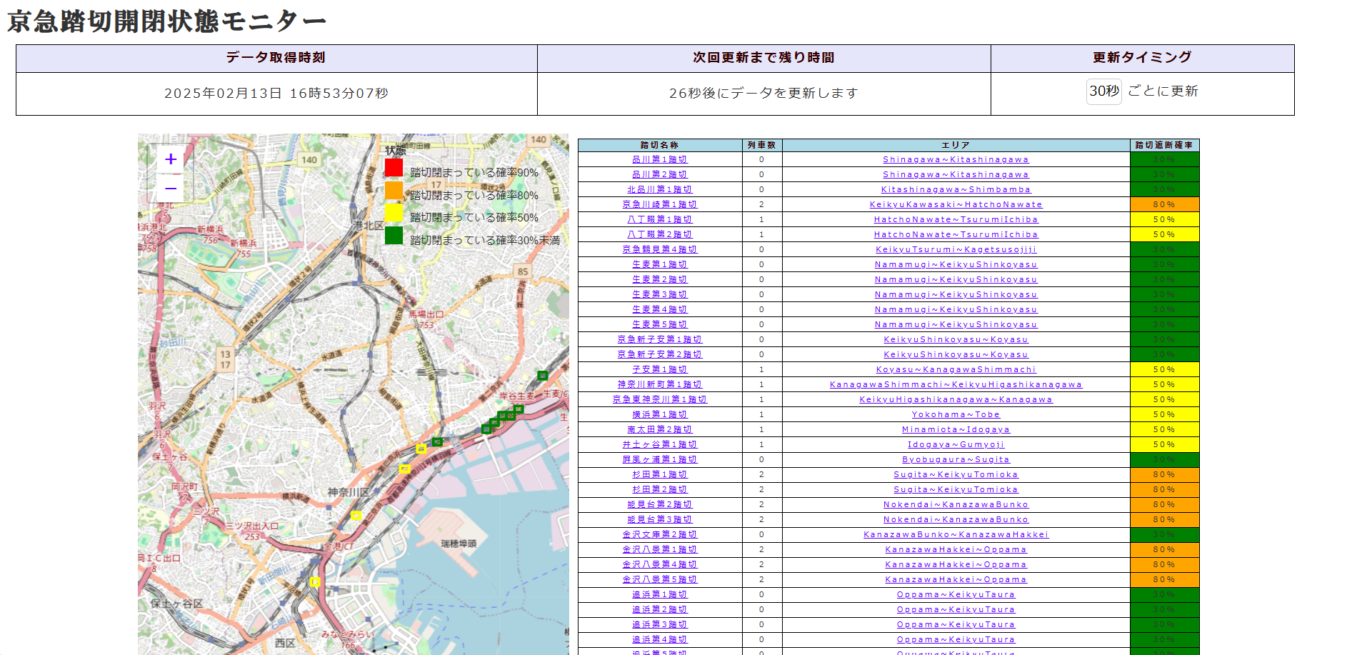
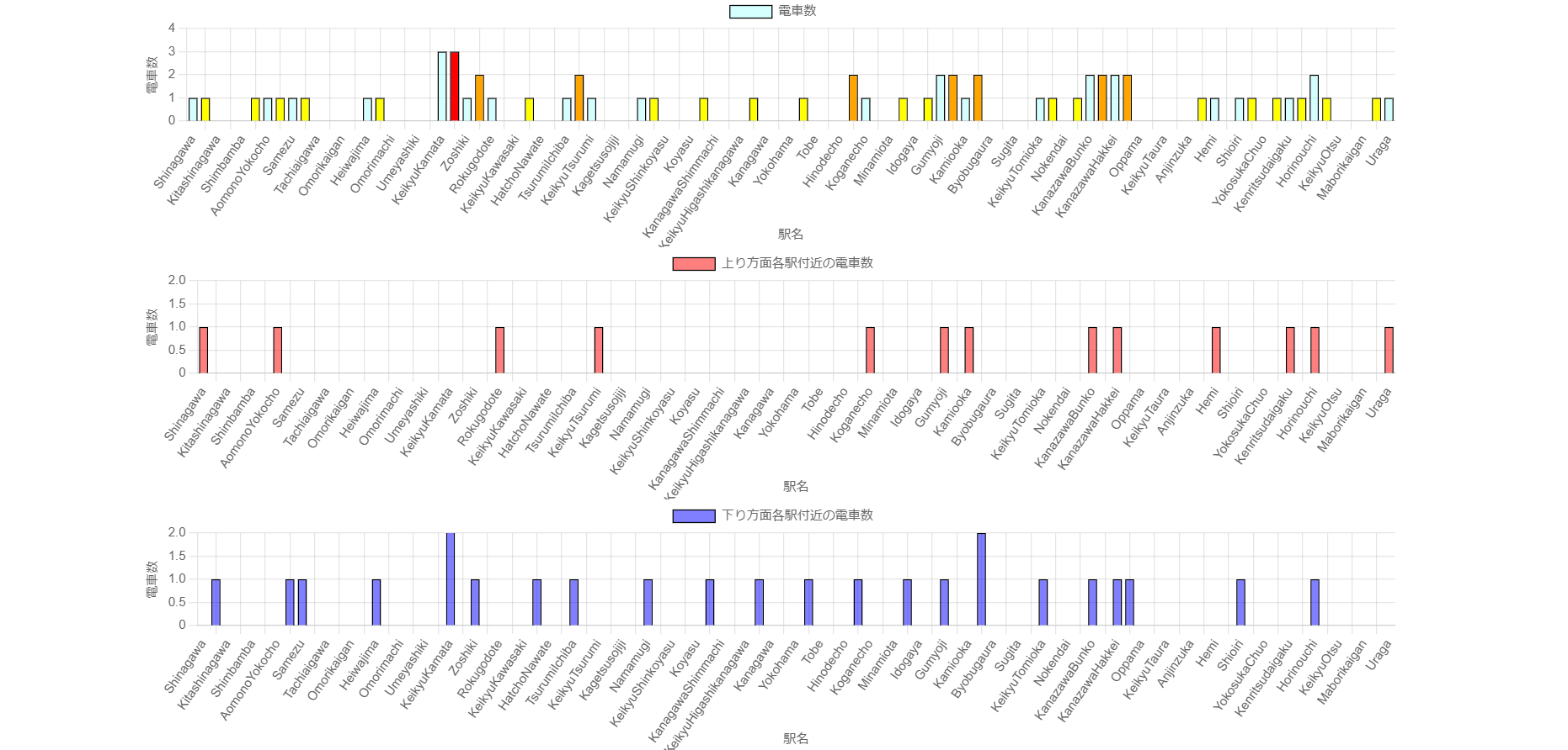
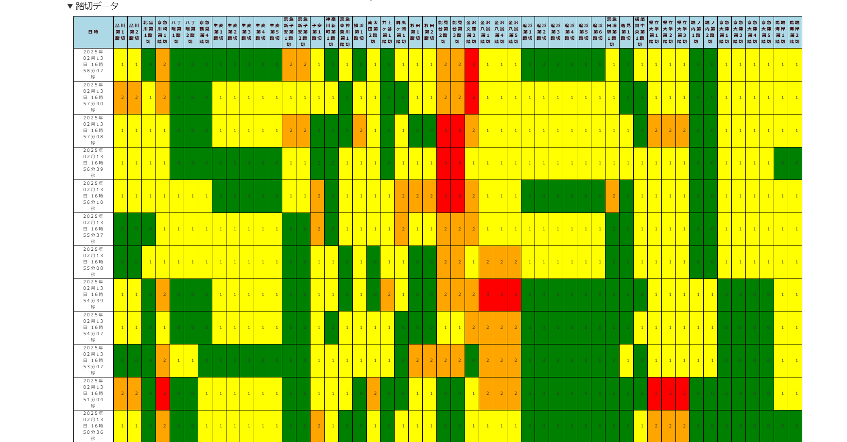
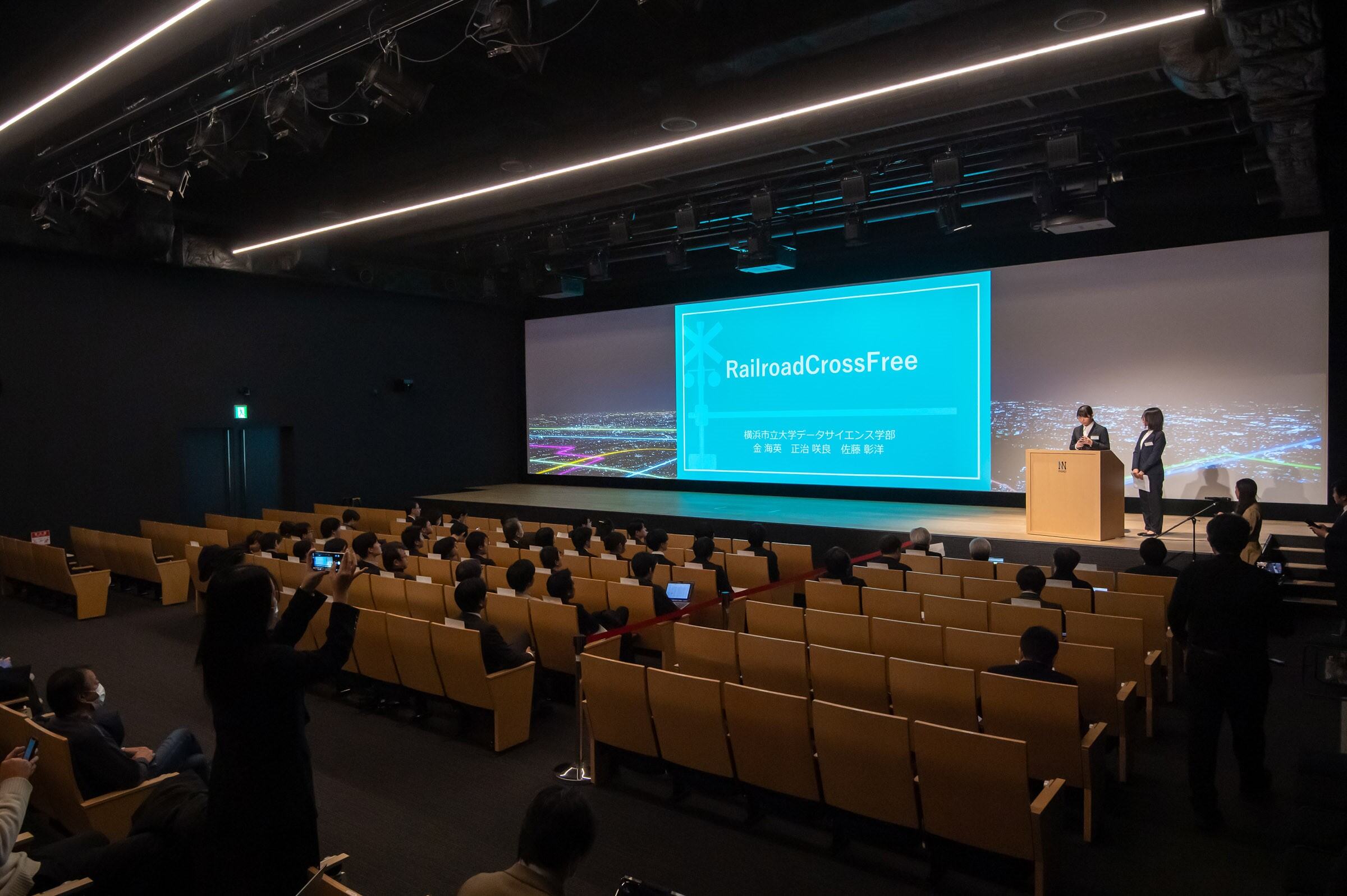
RailroadCrossFree visualizes the probability of stopping at railroad crossings to assist users to avoid long waits. It provides real-time crossing status predictions, train counts, and historical data for intuitive decision-making. The service currently supports 50 crossings on the Keikyu Main Line, enhancing users' travel efficiency.
Download

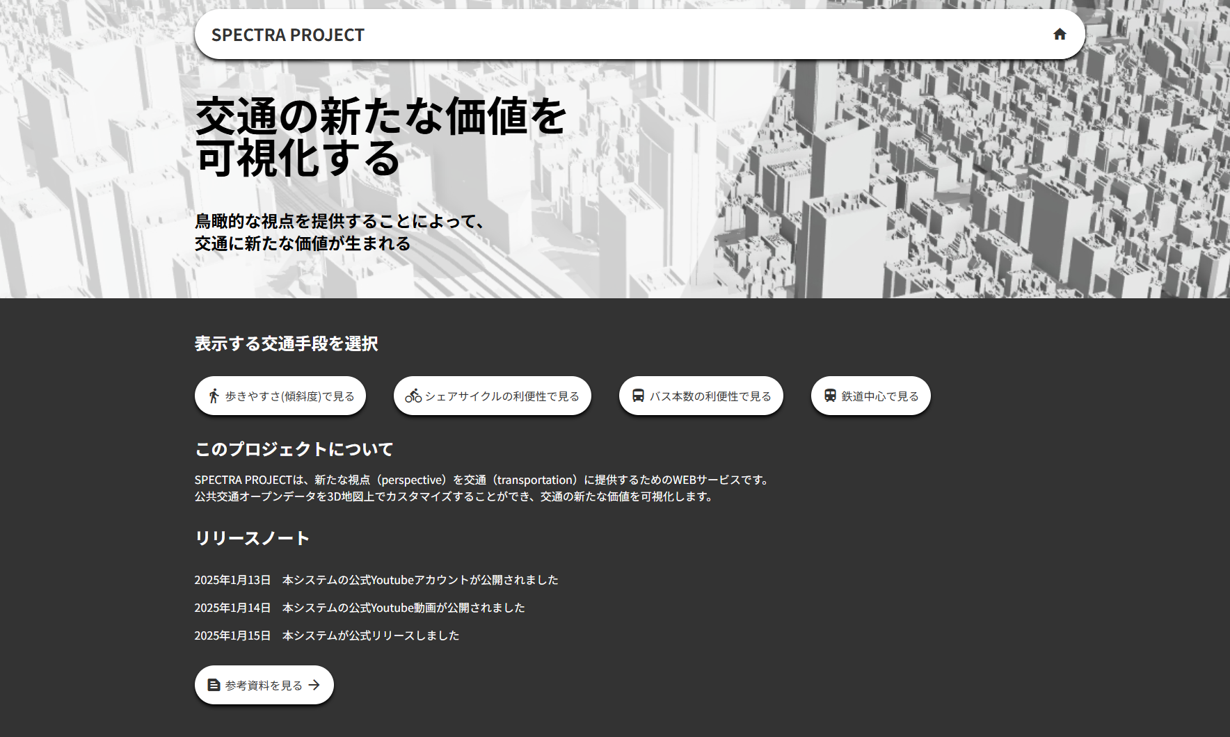
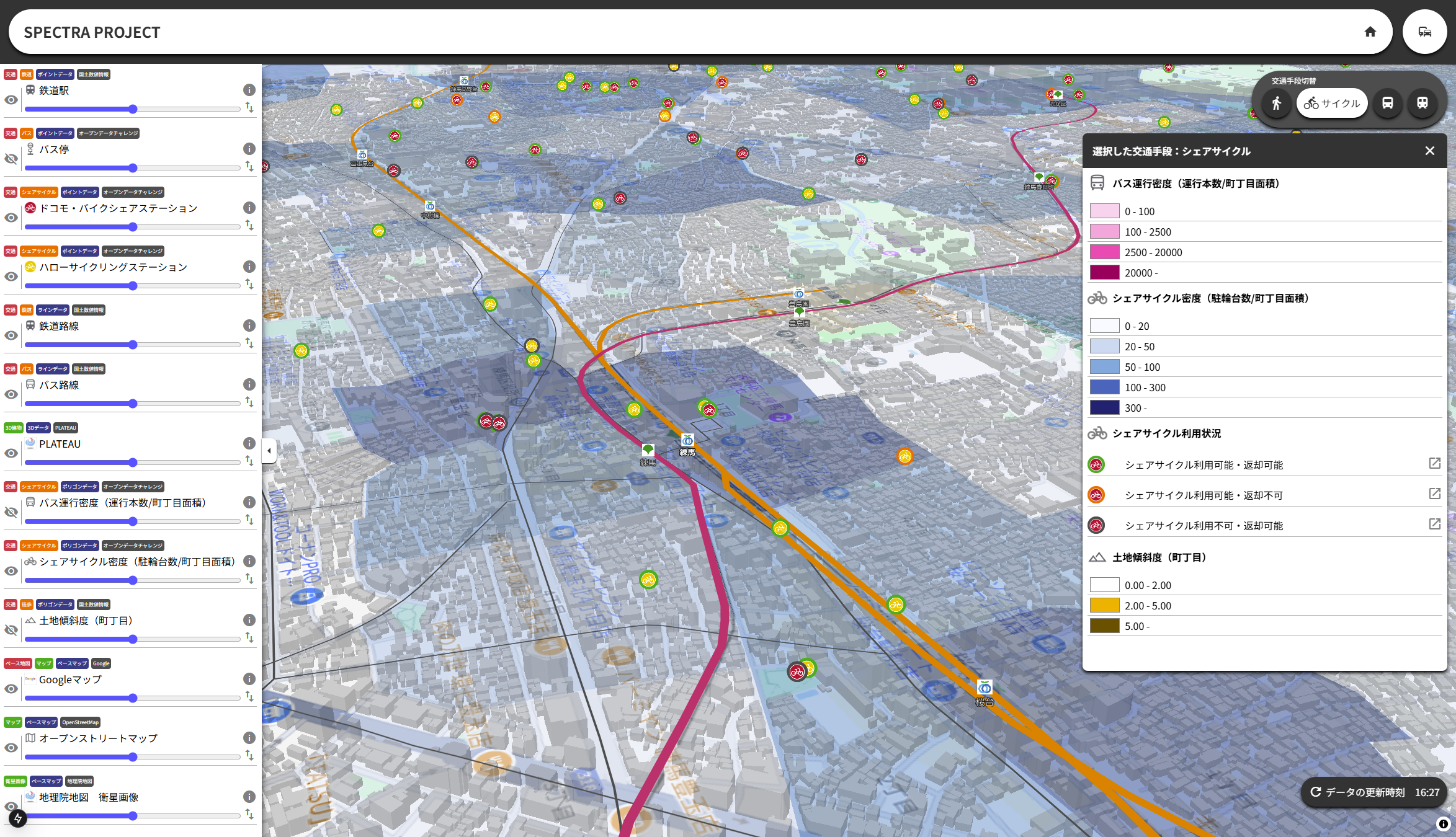
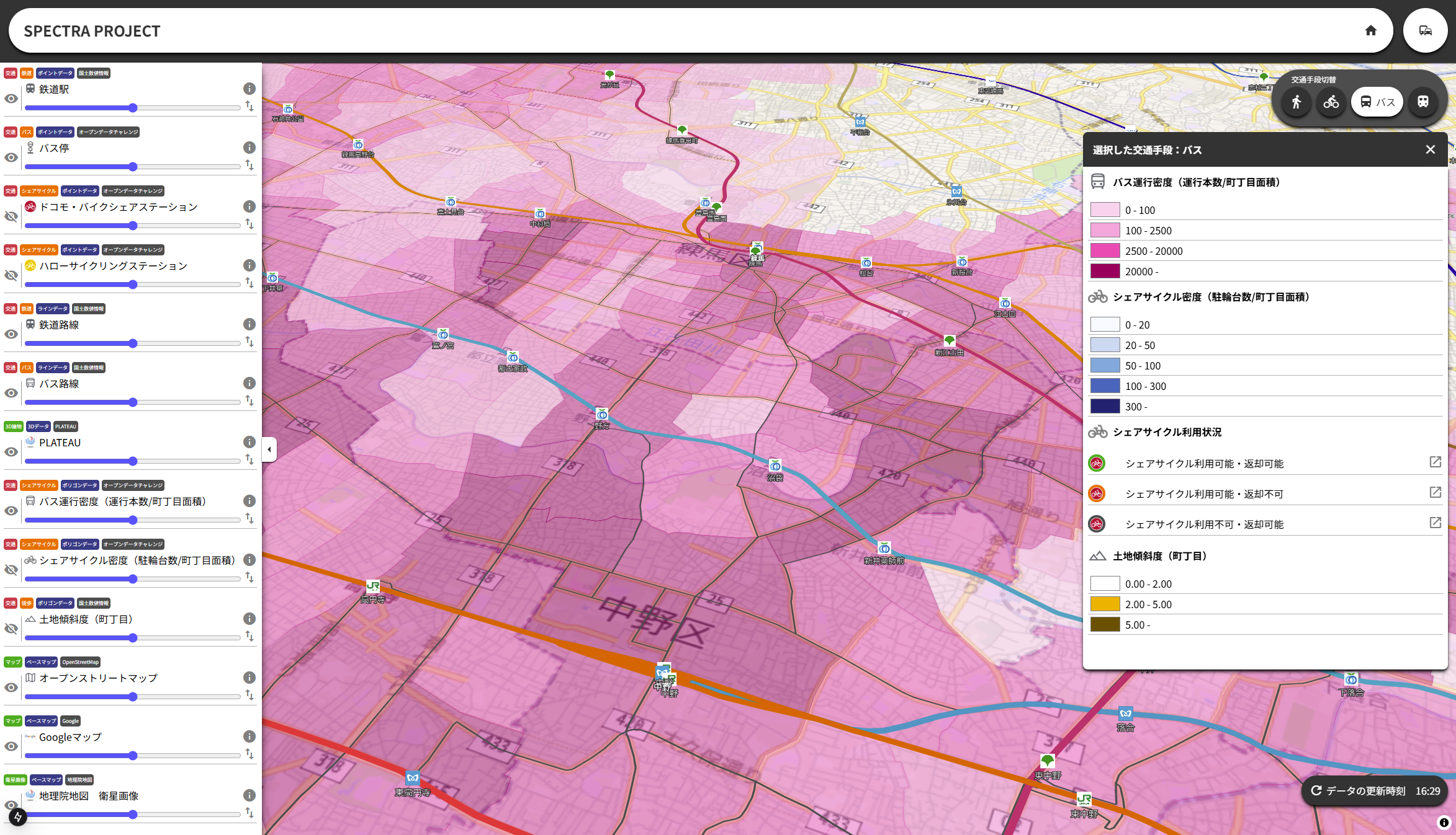
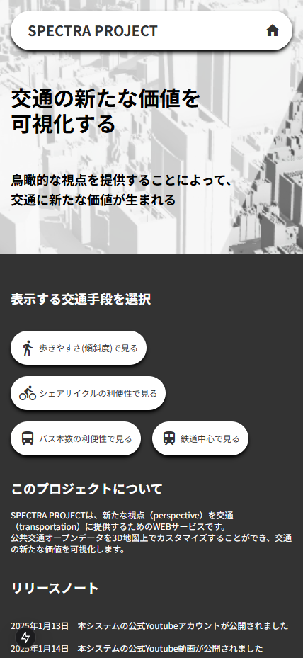
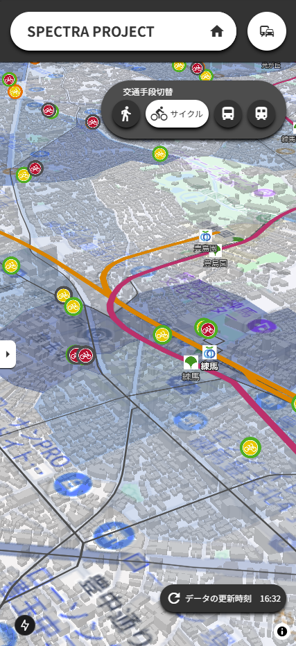
This web service overlays open data–based traffic accessibility indices with transit data and the PLATEAU 3D city model for comprehensive visualization. It supports municipal planning, reaffirms local value, and aids in emergency decisions such as evacuation and transit alternatives.
Download
□web app
https://traffic.quantum-rabbit.net/
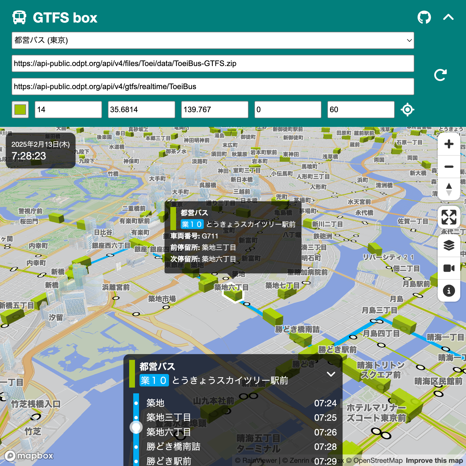
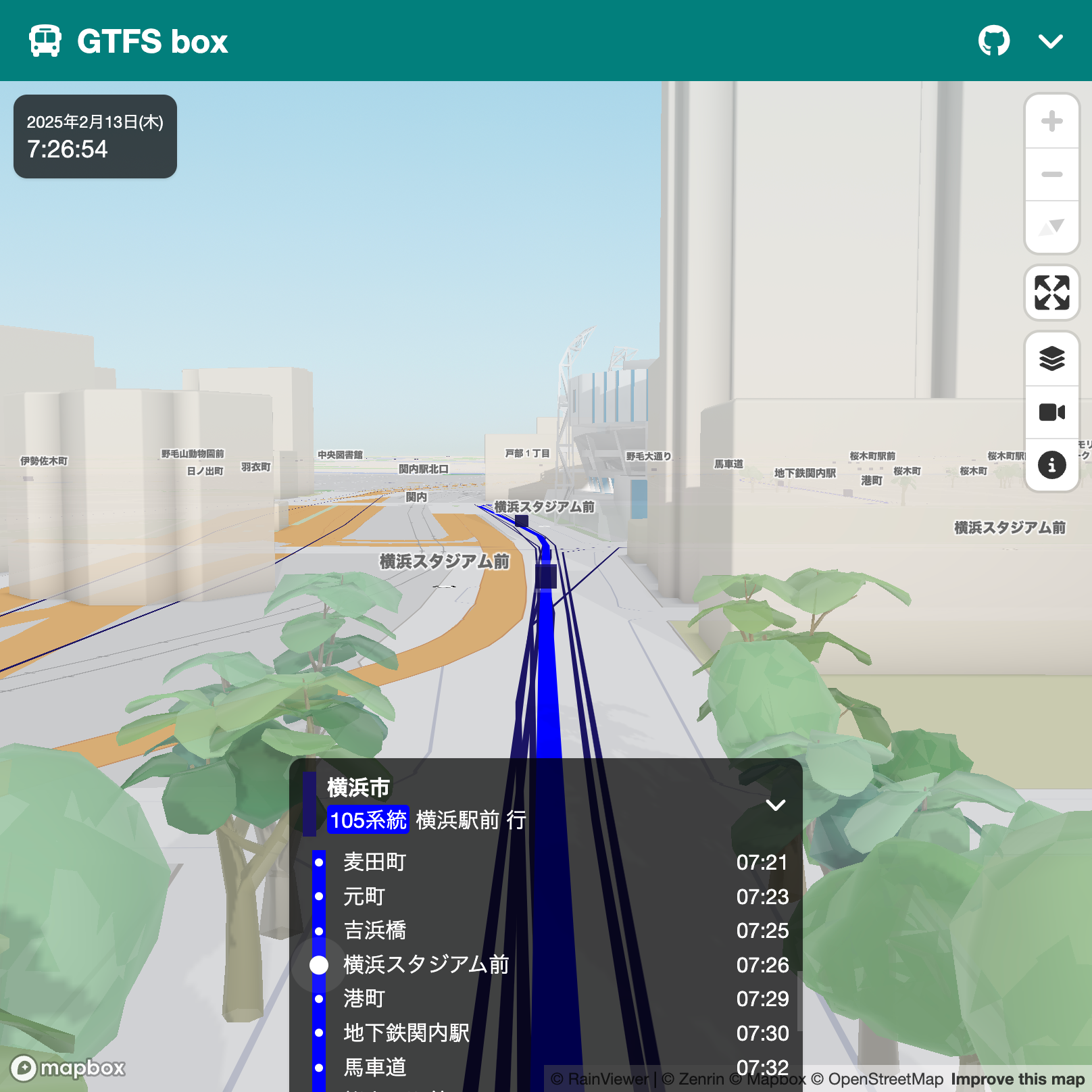
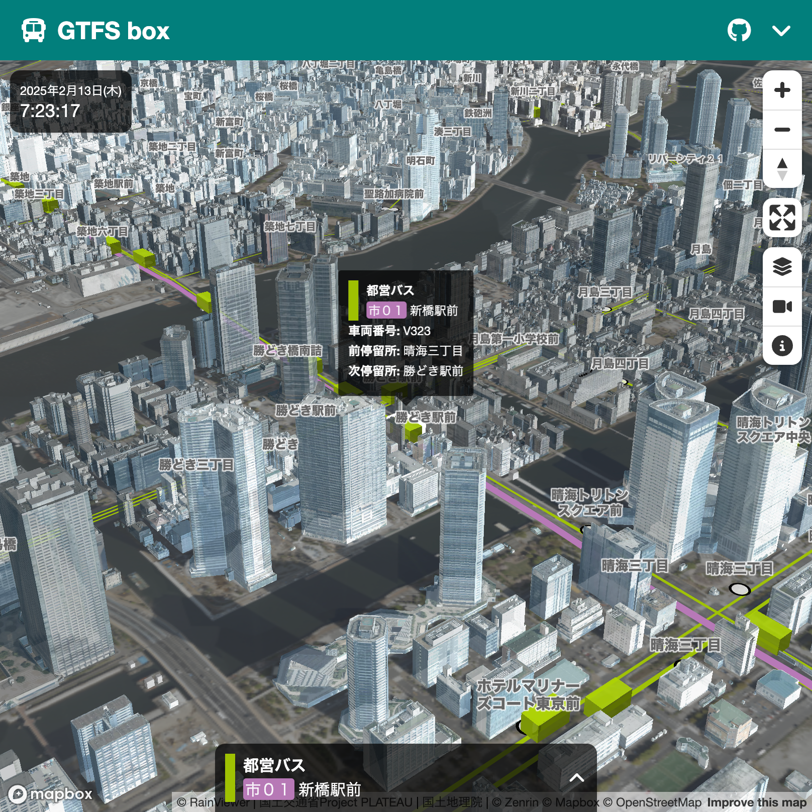
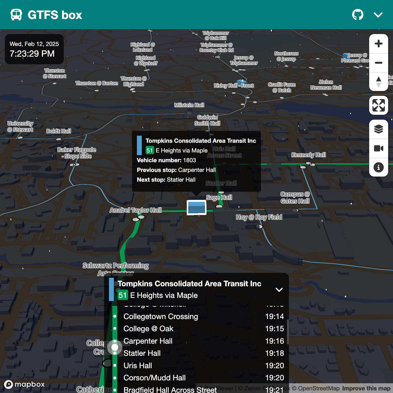
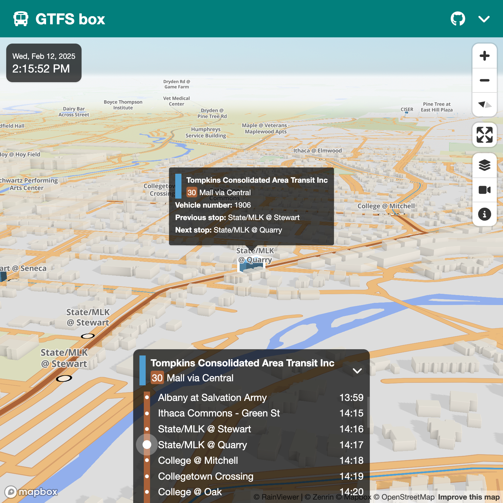
GTFS box is a web application that visualizes worldwide real-time public transport operations on a 3D map using GTFS/GTFS Realtime data. Utilizing Mini Tokyo 3D, it allows easy selection of preset datasets or custom URLs for display. Code is available on GitHub.
Download
□web app
https://nagix.github.io/gtfs-box
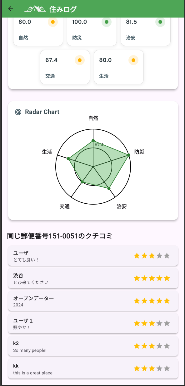
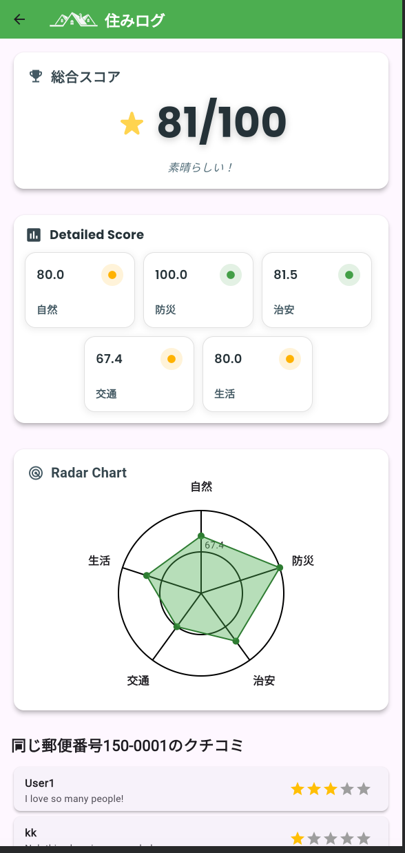
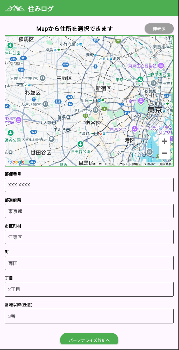
Sumilog is an app designed to ease the moving process by offering objective area scores based on nature, safety, disasters, transportation, and living aspects. It features real resident reviews, helping users make informed decisions, thus reducing information gaps and stress, and promoting safe and enriched community living.
Download
□web app
https://sumilog.github.io/

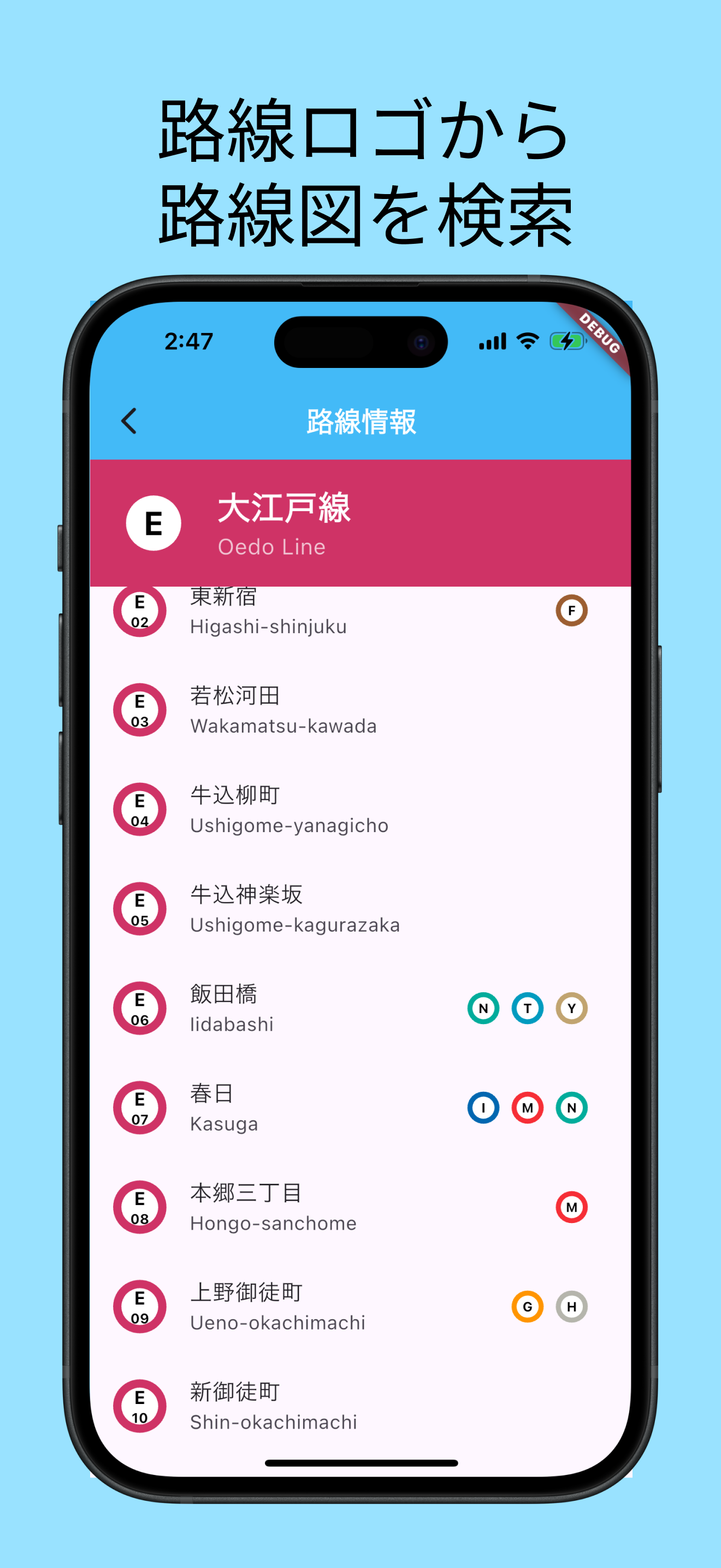
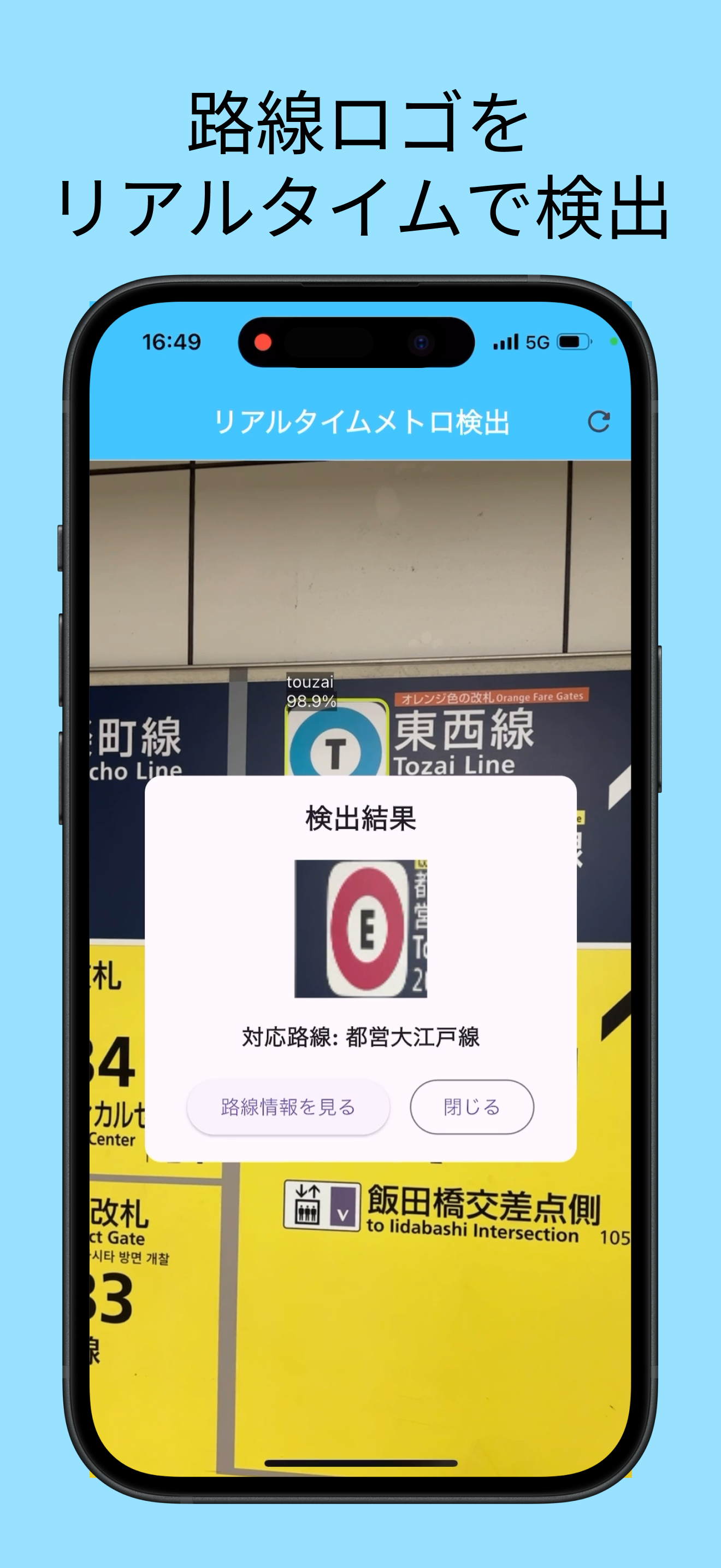
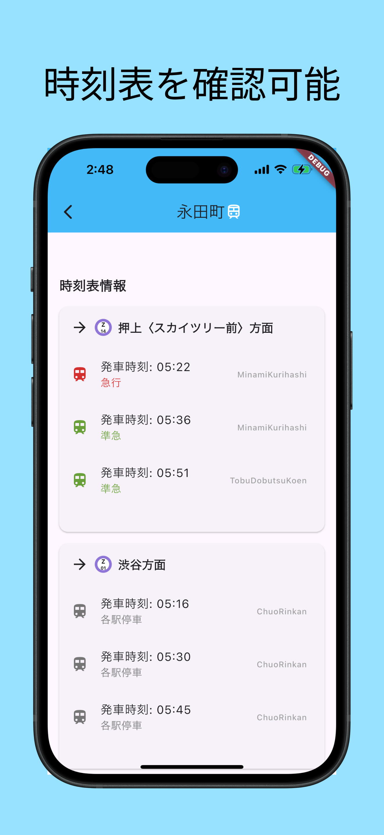
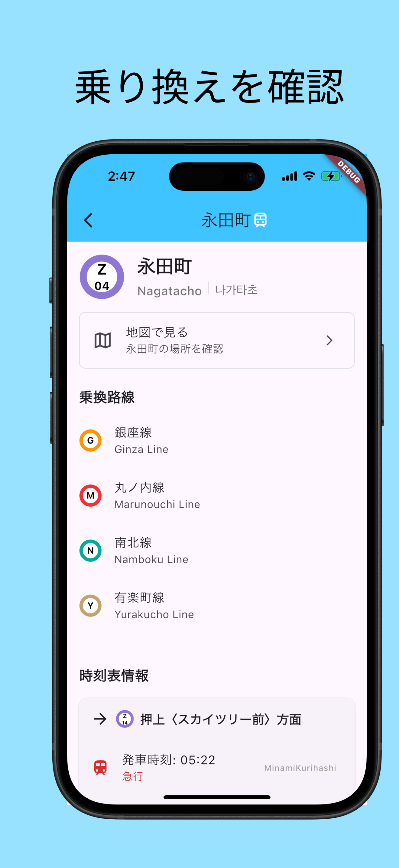
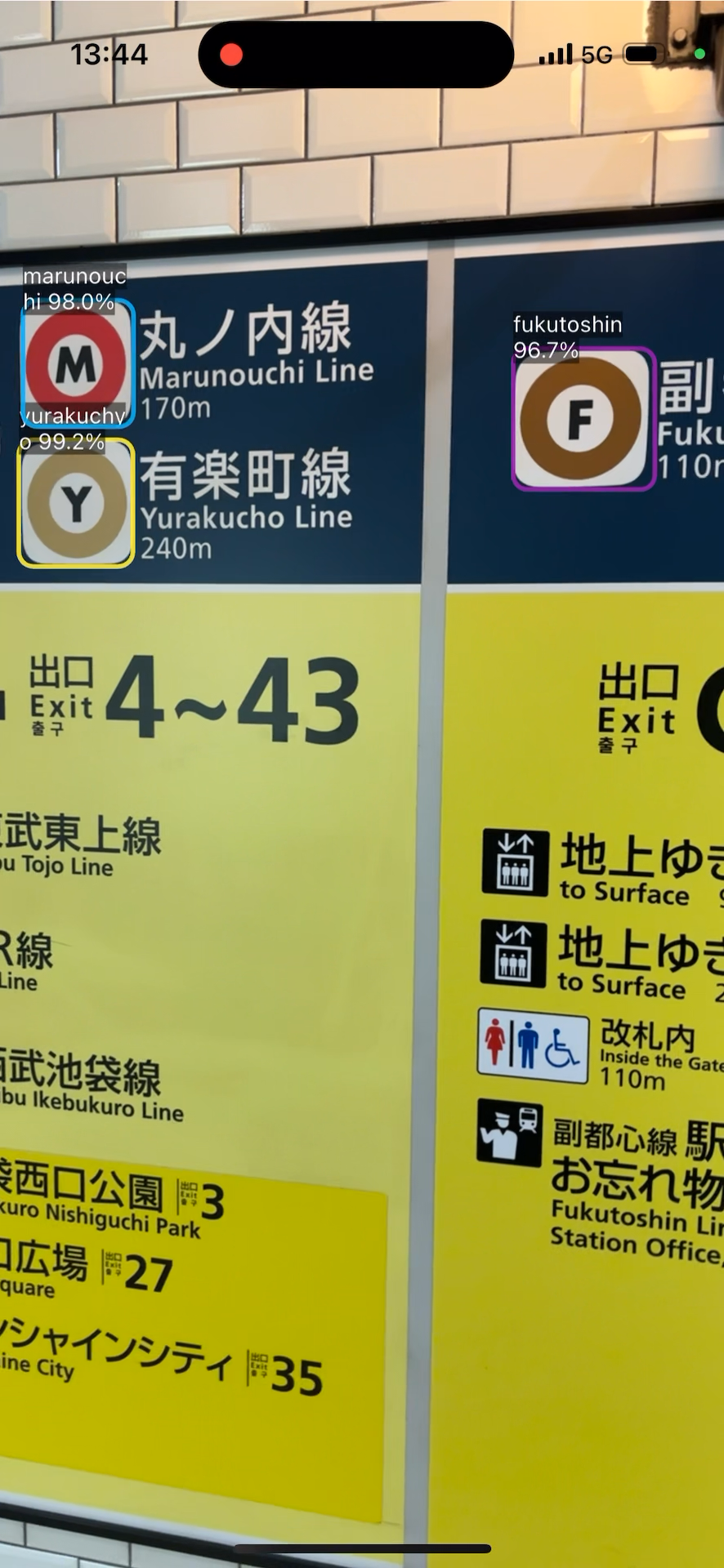
Metro Finder instantly provides Tokyo subway updates, routes, and timetables by scanning a line logo with your phone. Powered by an on-device AI model for fast, secure recognition, it displays near-realistic graphics and offers a nonverbal search feature, breaking language barriers. Navigate Tokyo’s subways effortlessly with this innovative app.
Download

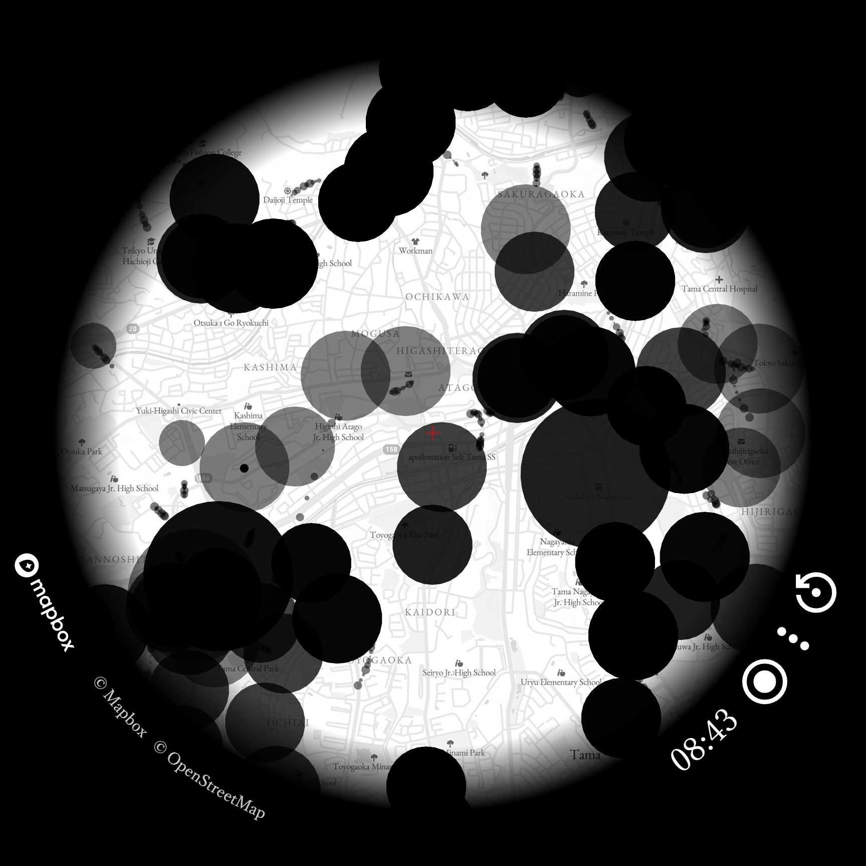
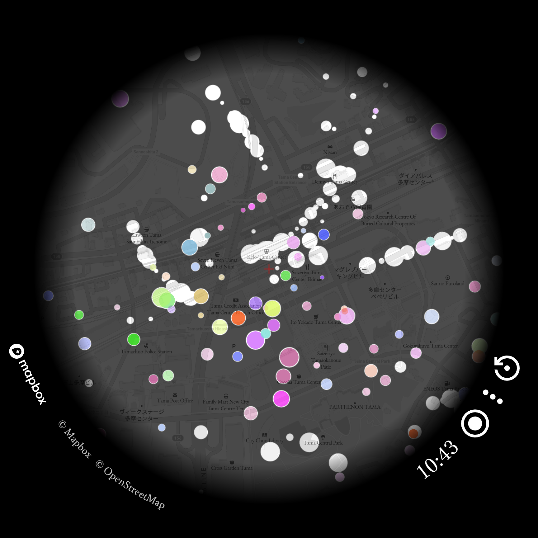
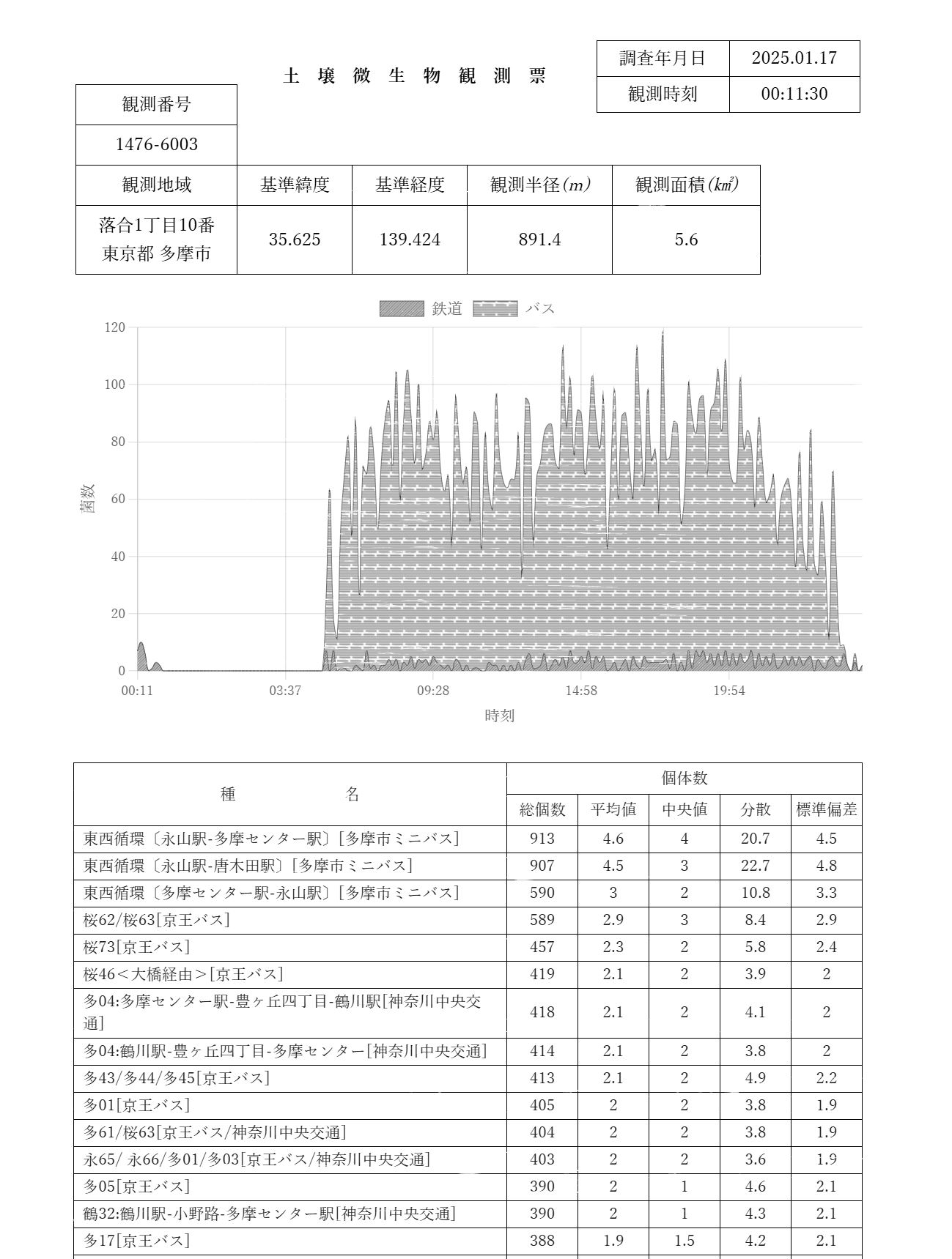
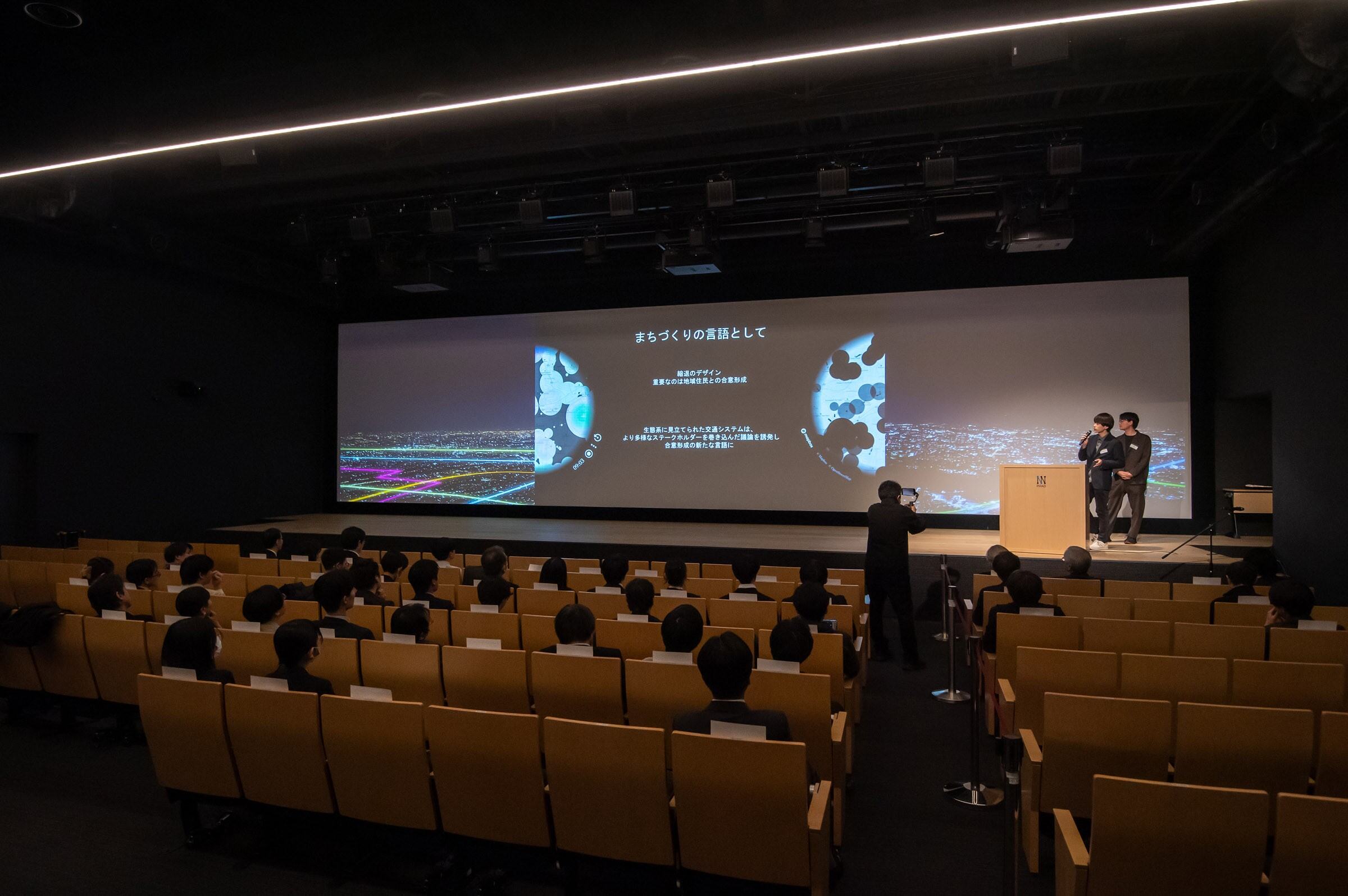
Annelida reinterprets public transportation as an ecosystem, visualizing transit deserts and network diversity. Using GTFS data, it integrates spatial, temporal, and attribute data for accessibility assessments. Inspired by earthworm ecosystems, it provides policymakers with insights while fostering a shared language in communities to enhance understanding and consensus on transit policies.
Download
□web app
https://mimizu.onrender.com/
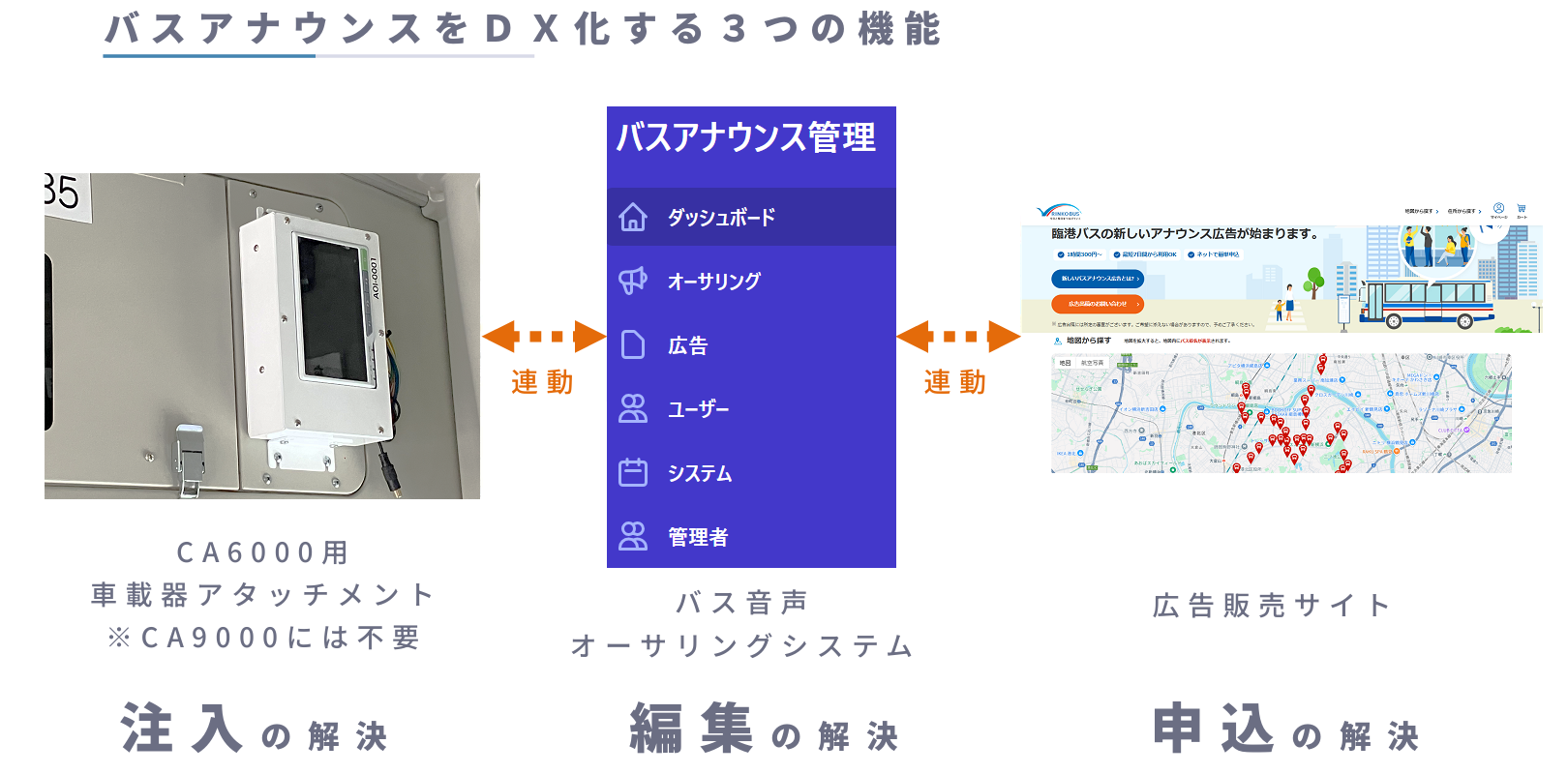
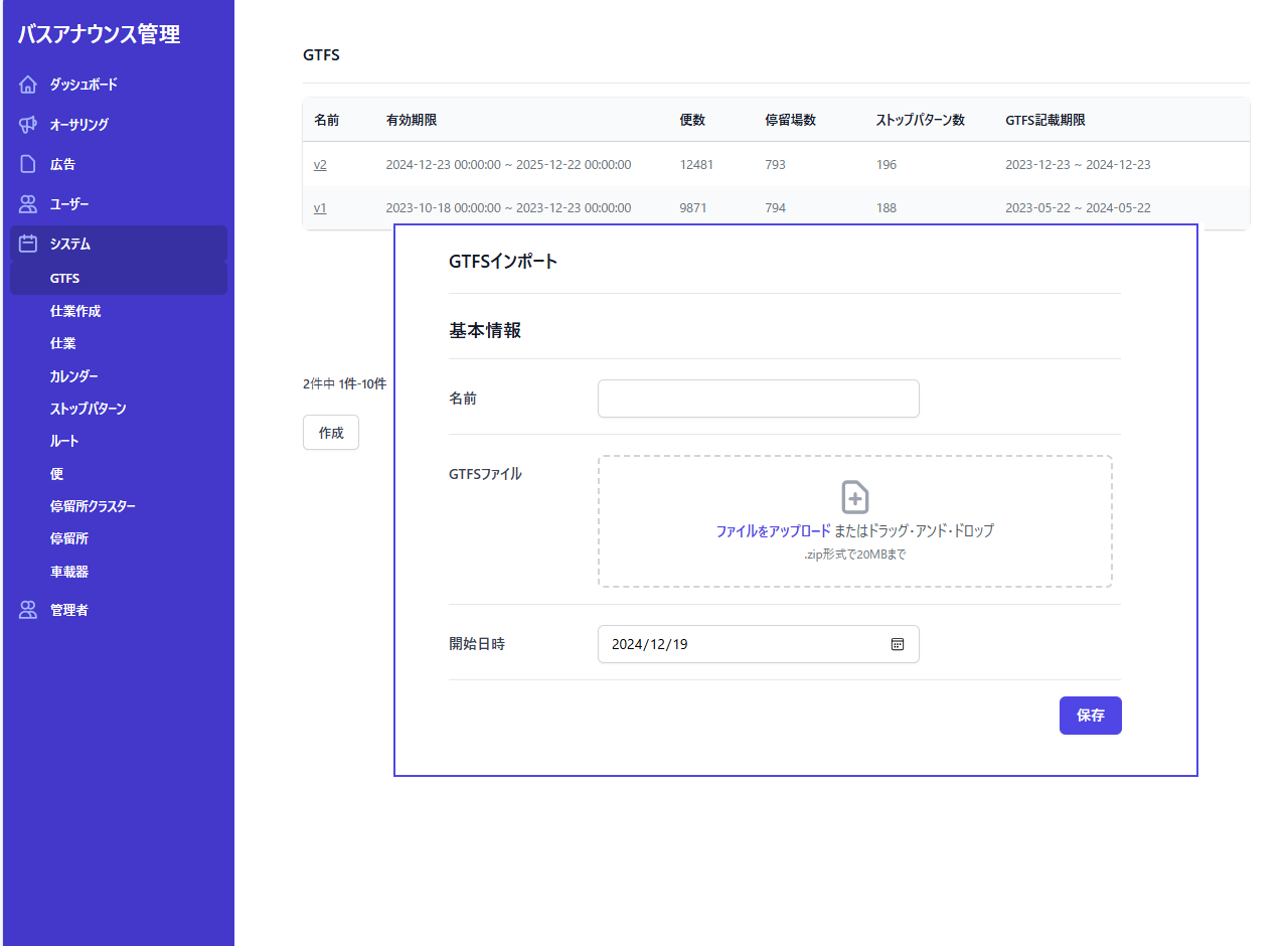
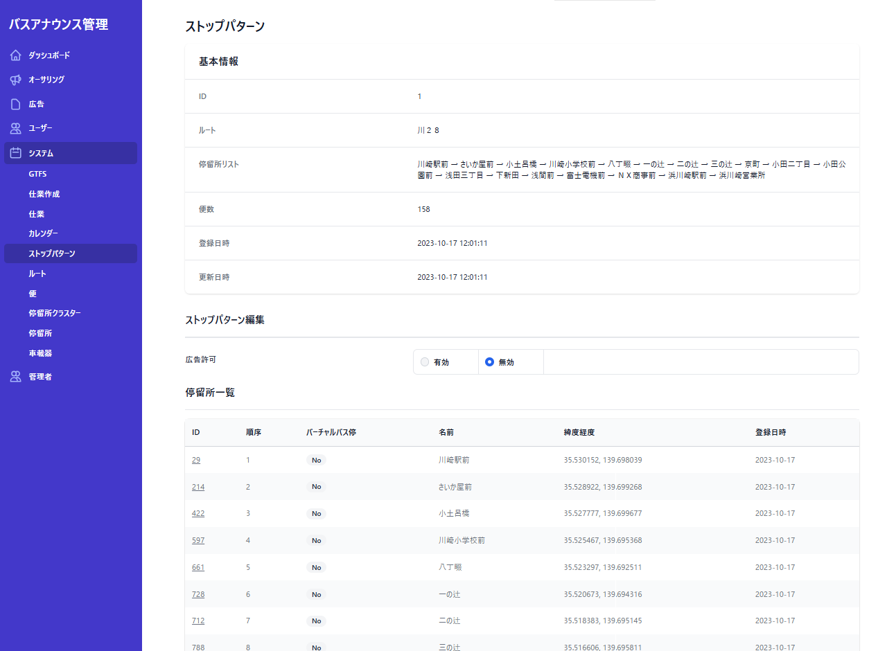
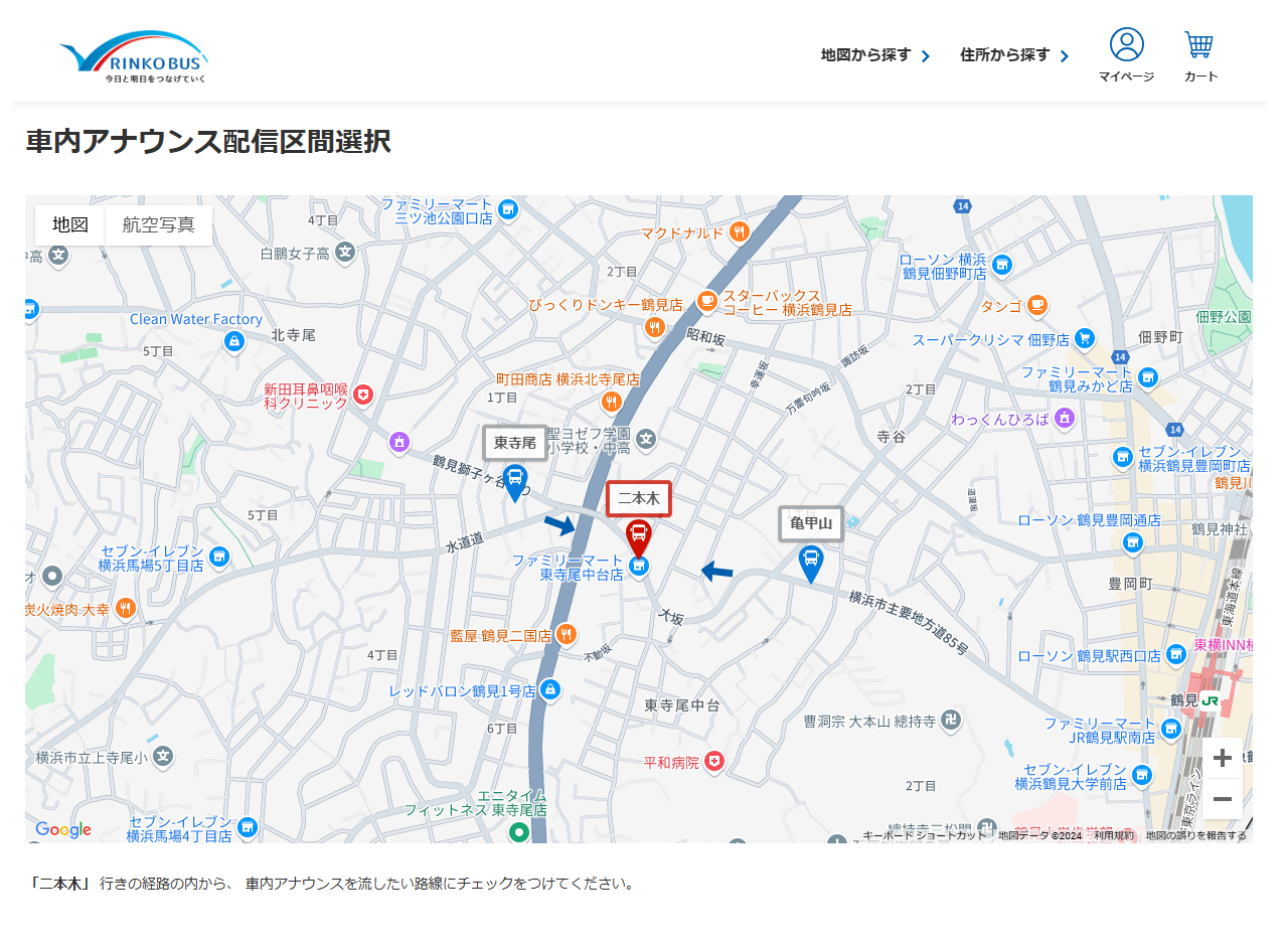
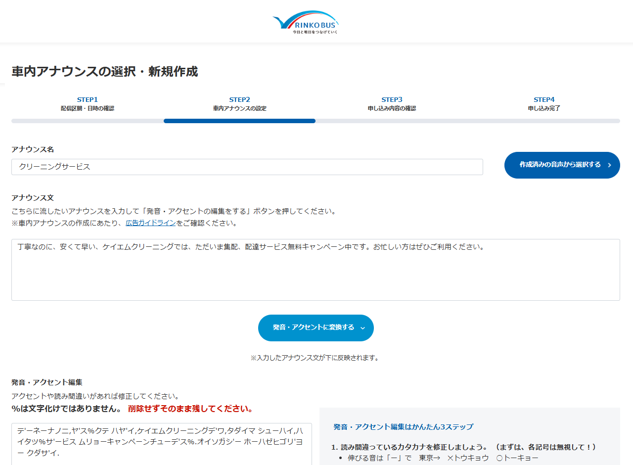
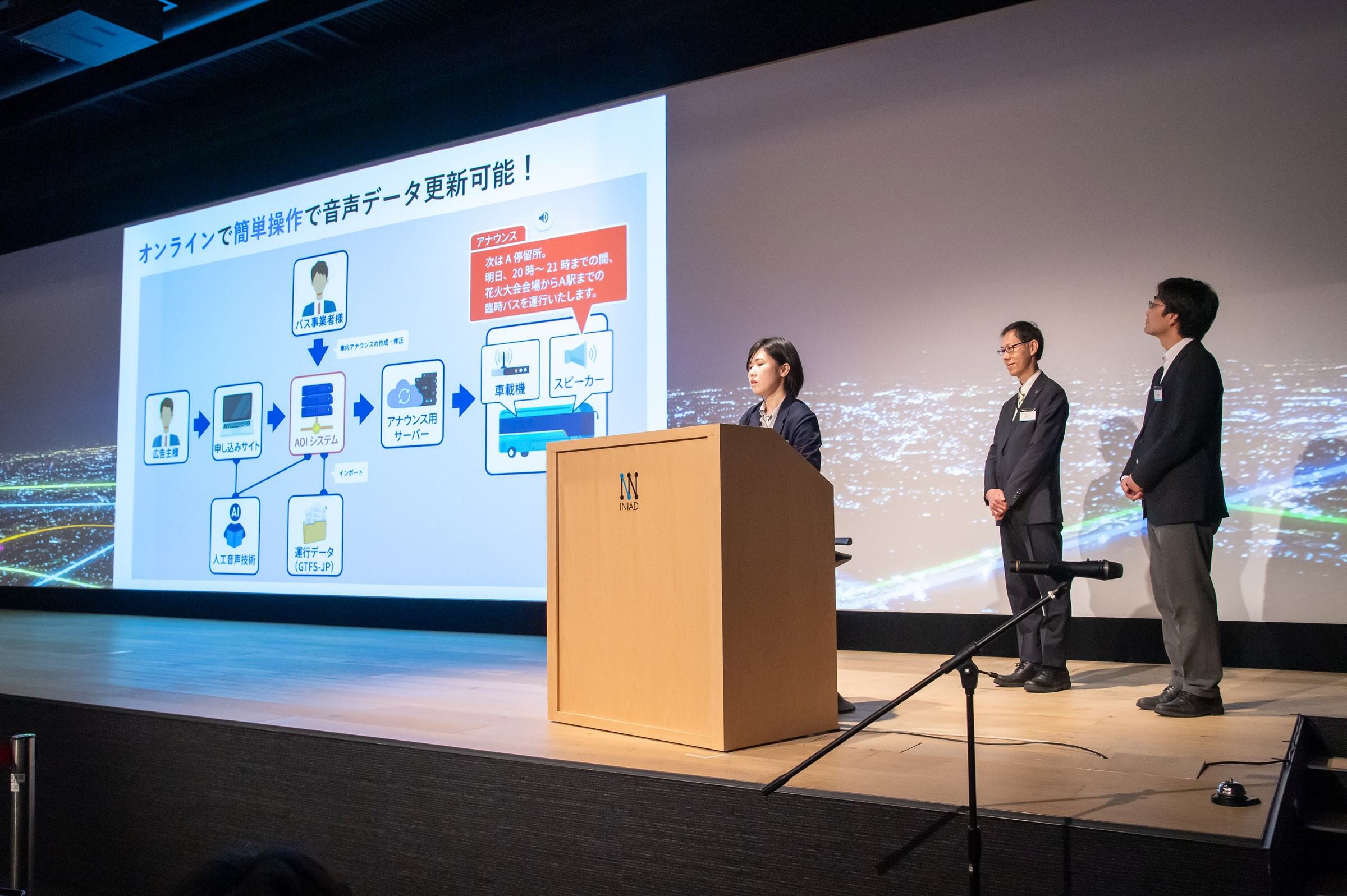
The “AOI system” can update bus announce data instantly by connecting to the internet line. The AOI system reduces workload of bus operators dramatically by integration with GTFS data. Moreover, bus companies can expect more ad income by opening web site for purchasing sponsors.
Download
□web app
https://test.aoi-system.com/

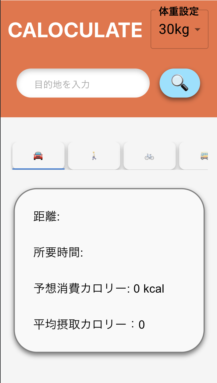
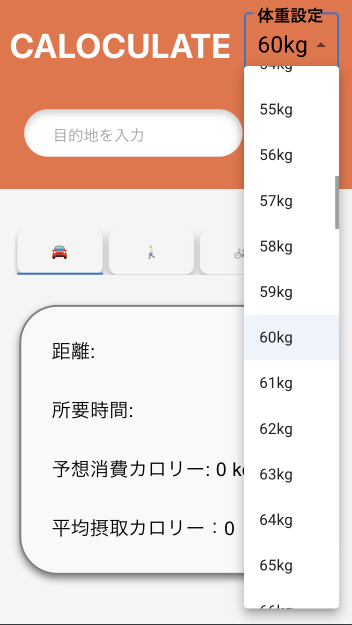
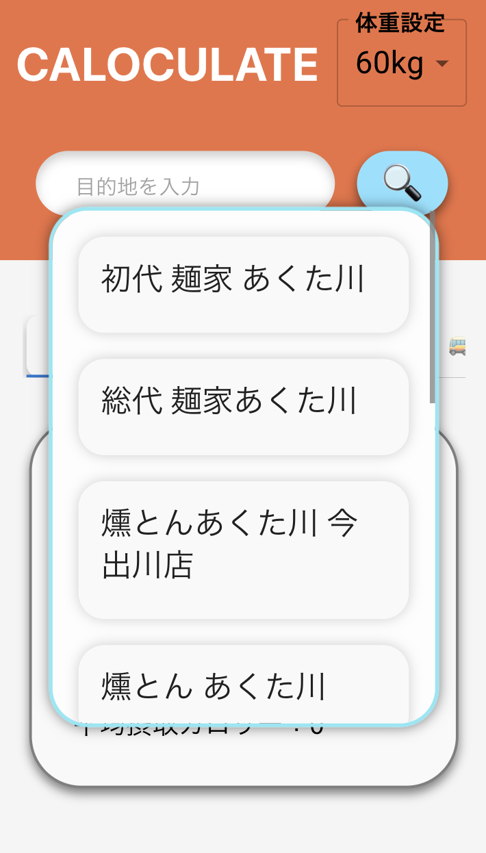
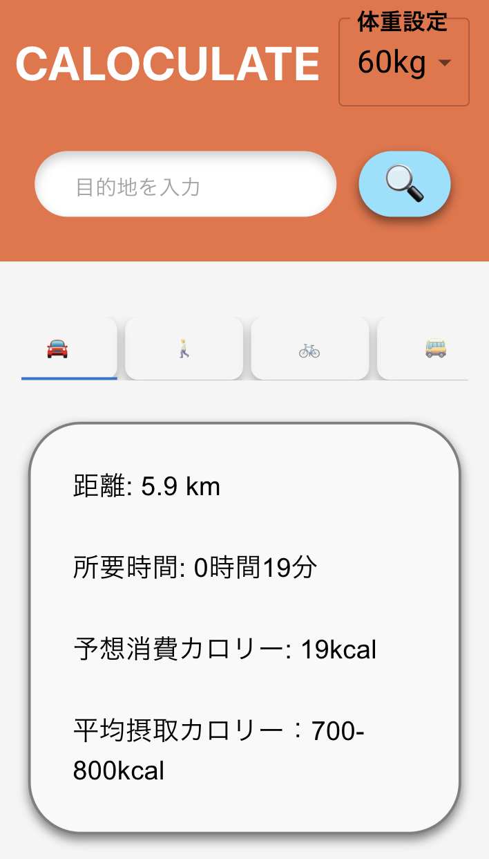
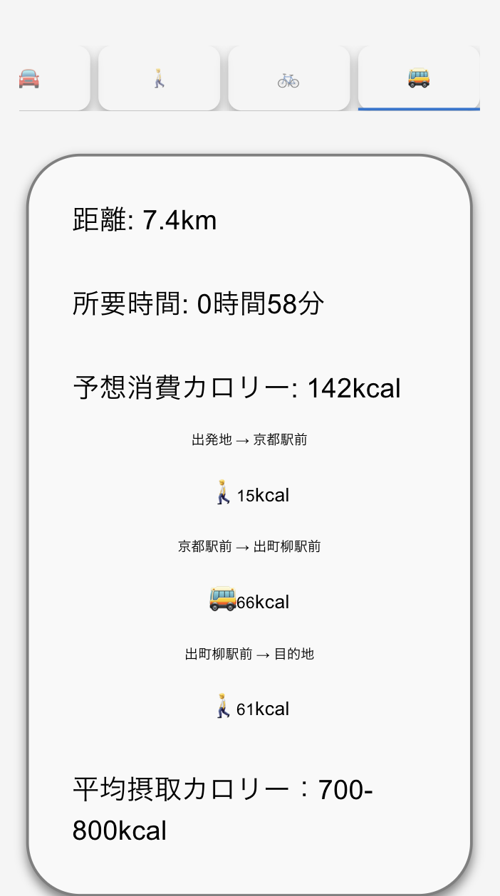
CALOCULATE uses AI and METs to predict calorie consumption and intake, visualizing calorie balance to promote healthier lifestyles. It incorporates real-time bus crowd data to estimate calories burned and promote rest, aiming to solve issues like lack of exercise and stress, thus extending healthy life expectancy.
Download
□web app
https://next-calorie-app.vercel.app/
This app allows users to quickly search if a bus passing by their stop will take them near their destination, utilizing open public transit data for efficient and easy navigation.
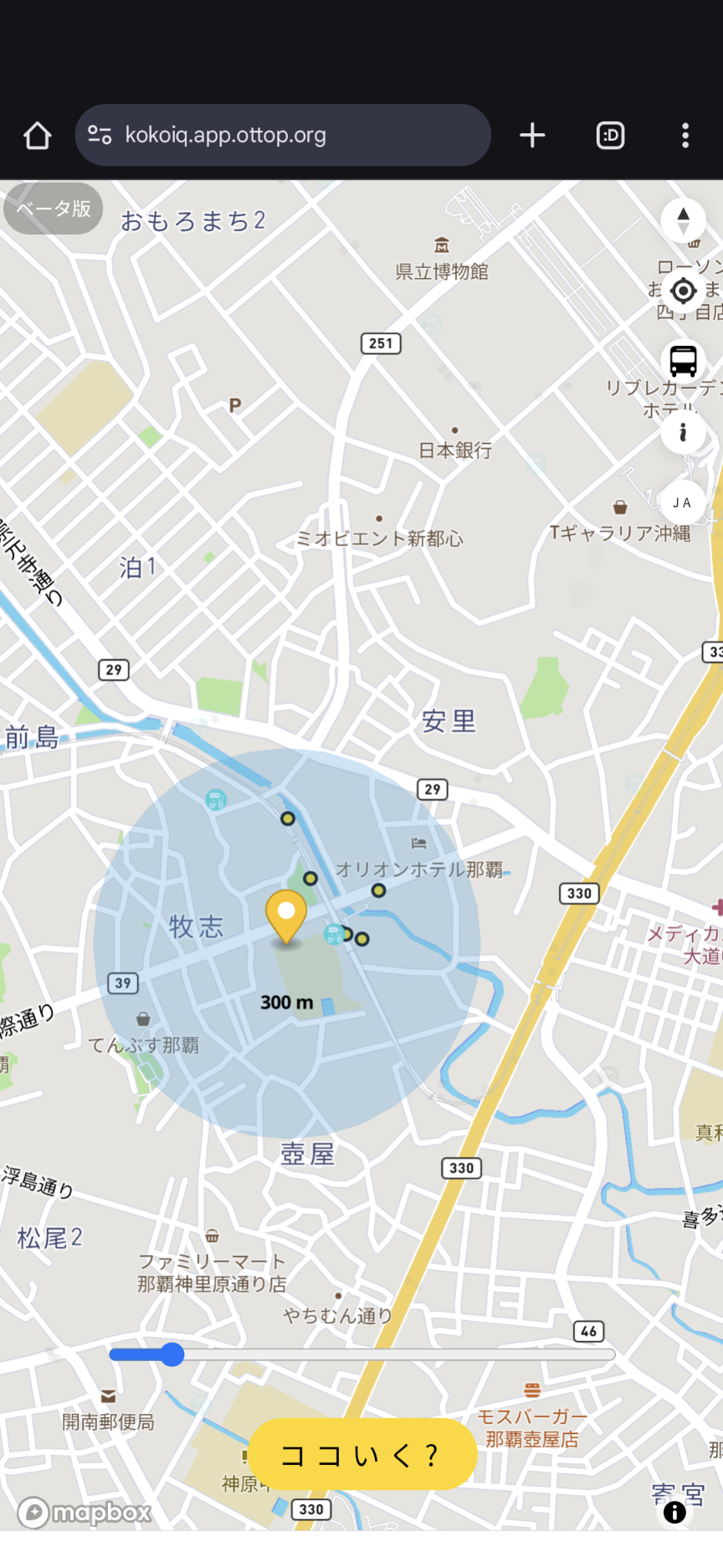
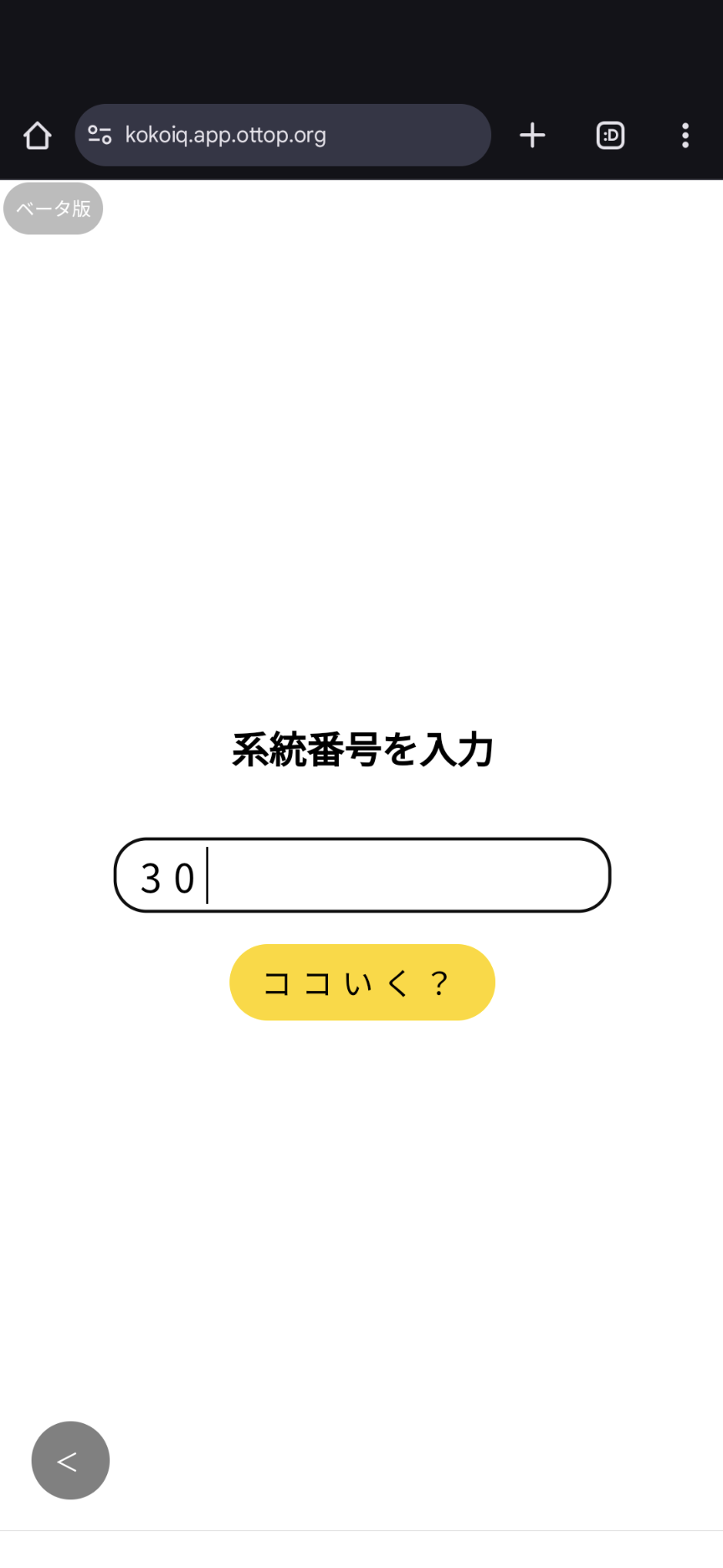
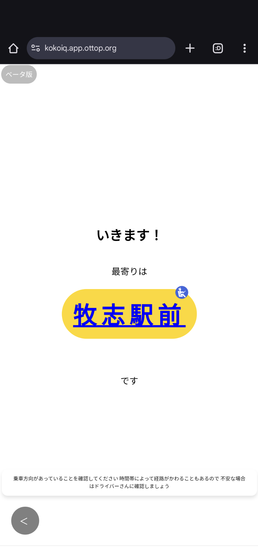
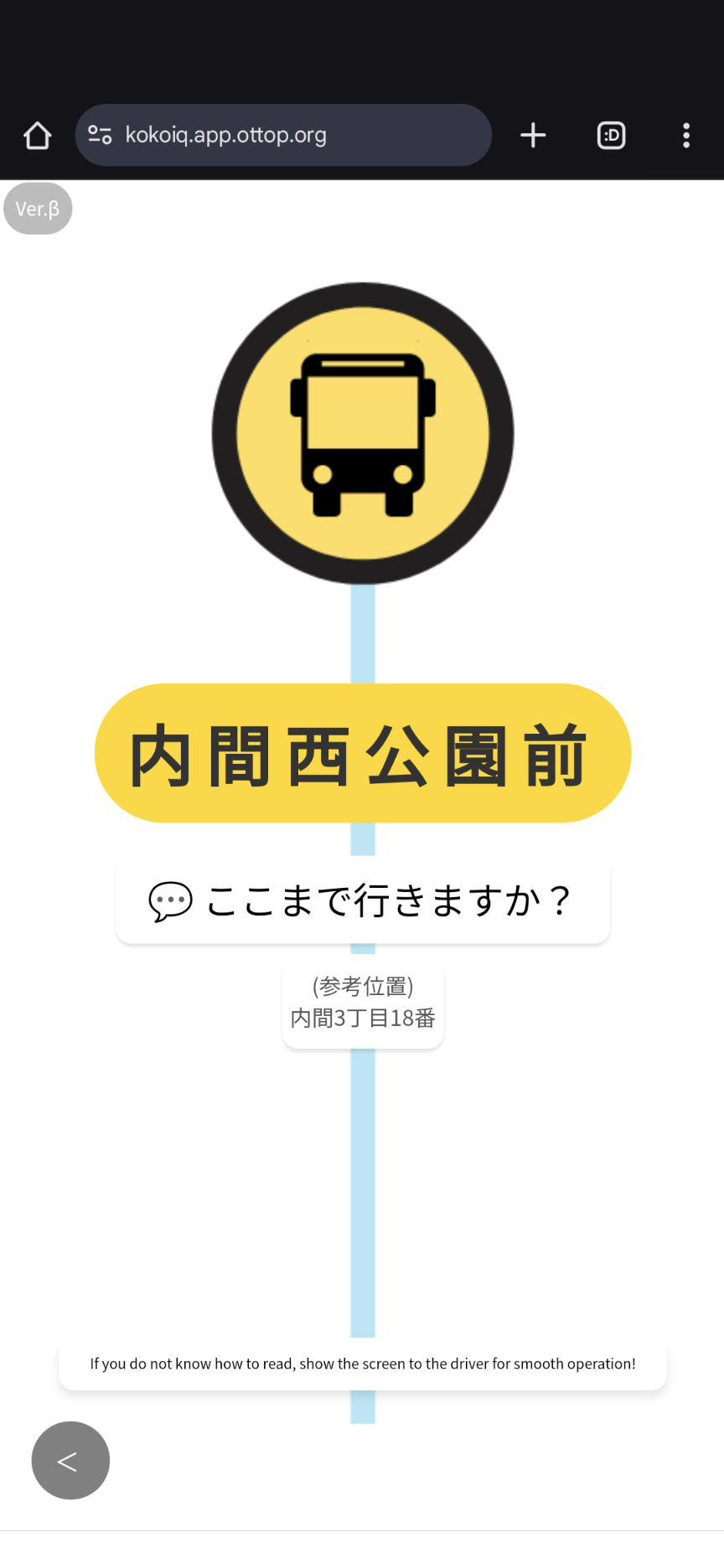
Download
□web app
https://kokoiq.app.ottop.org/

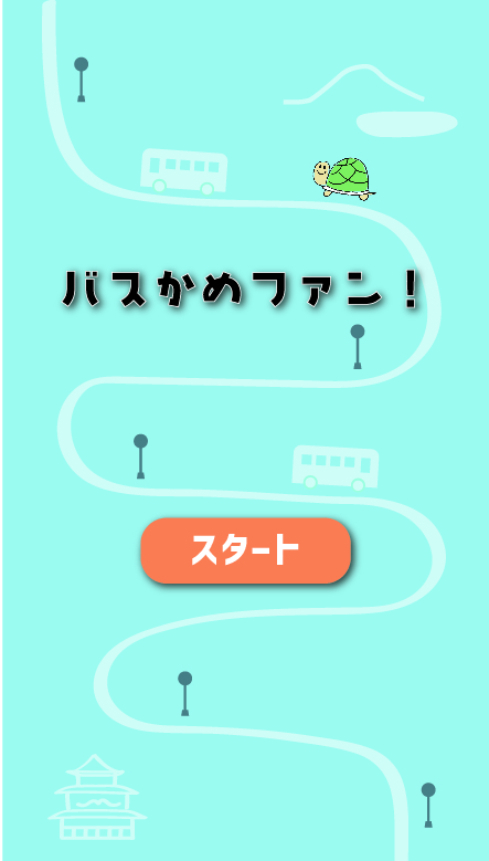
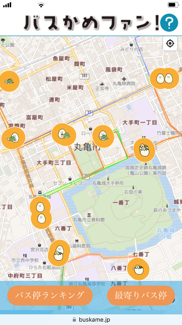
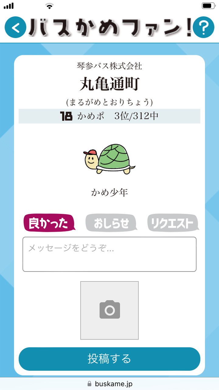
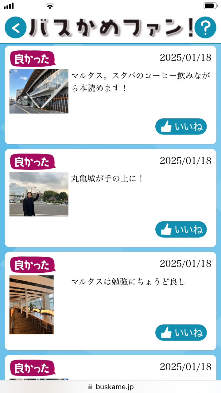
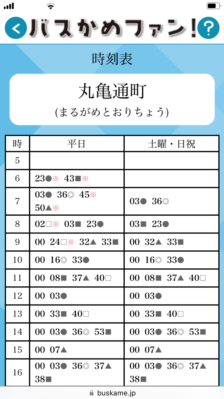
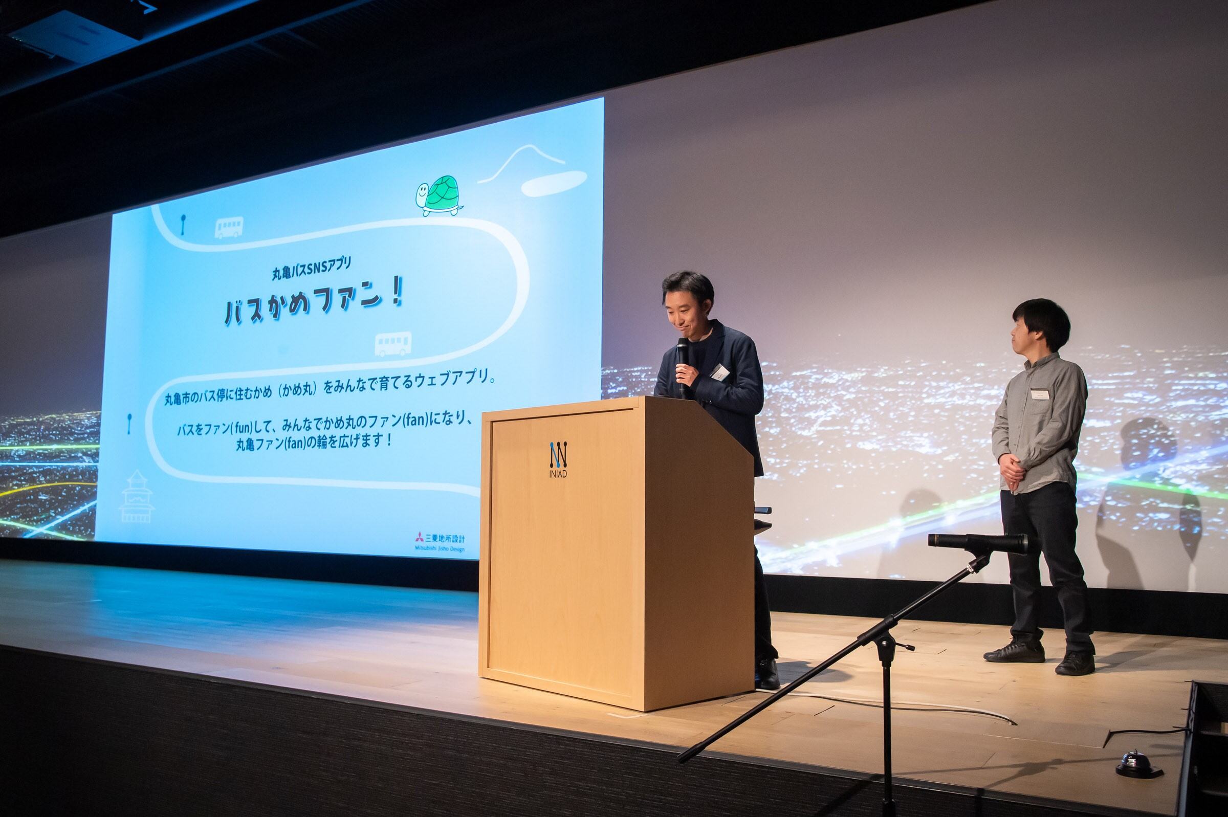
"Bus Kame Fan!" is a web app promoting Marugame's bus stop info and local attractions, engaging users with character growth and community contributions. It connects residents and tourists, boosting public transport use and community development for a new town-building initiative.
Download
□web app
https://buskame.jp/
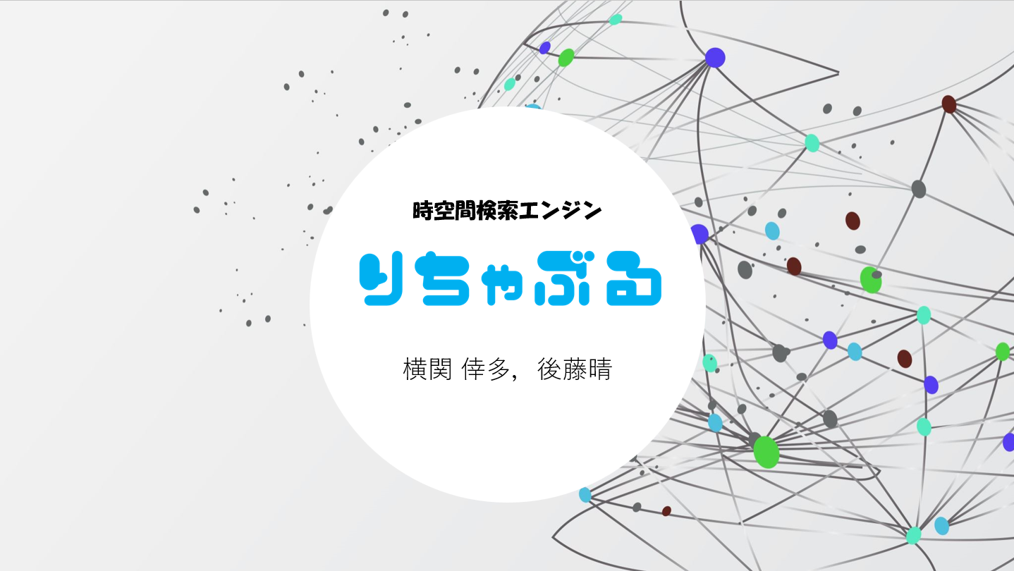
"Reachable" is a spatial-temporal search engine that lists accessible areas based on travel time. It enhances the exploration of undiscovered places and promotes public transport use, aiding regional revitalization. This tool offers new value in daily life, making travel more efficient for commuting, sightseeing, and shopping.

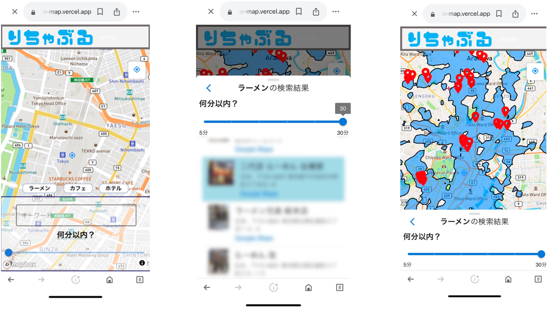
Download
□web app
https://reachable-map.vercel.app/
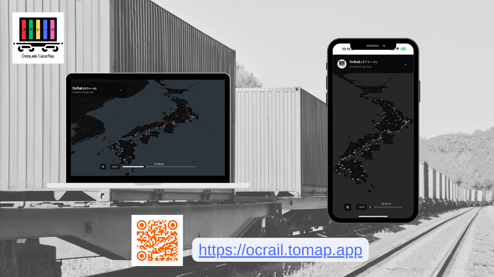
We are developing a map app to visualize and explore JR Freight’s distribution network. Since raw GTFS data is hard to use, we restructured it for better accessibility. This project aims to enhance public data usability, propose new formats, and extend GTFS for detailed freight transport information.
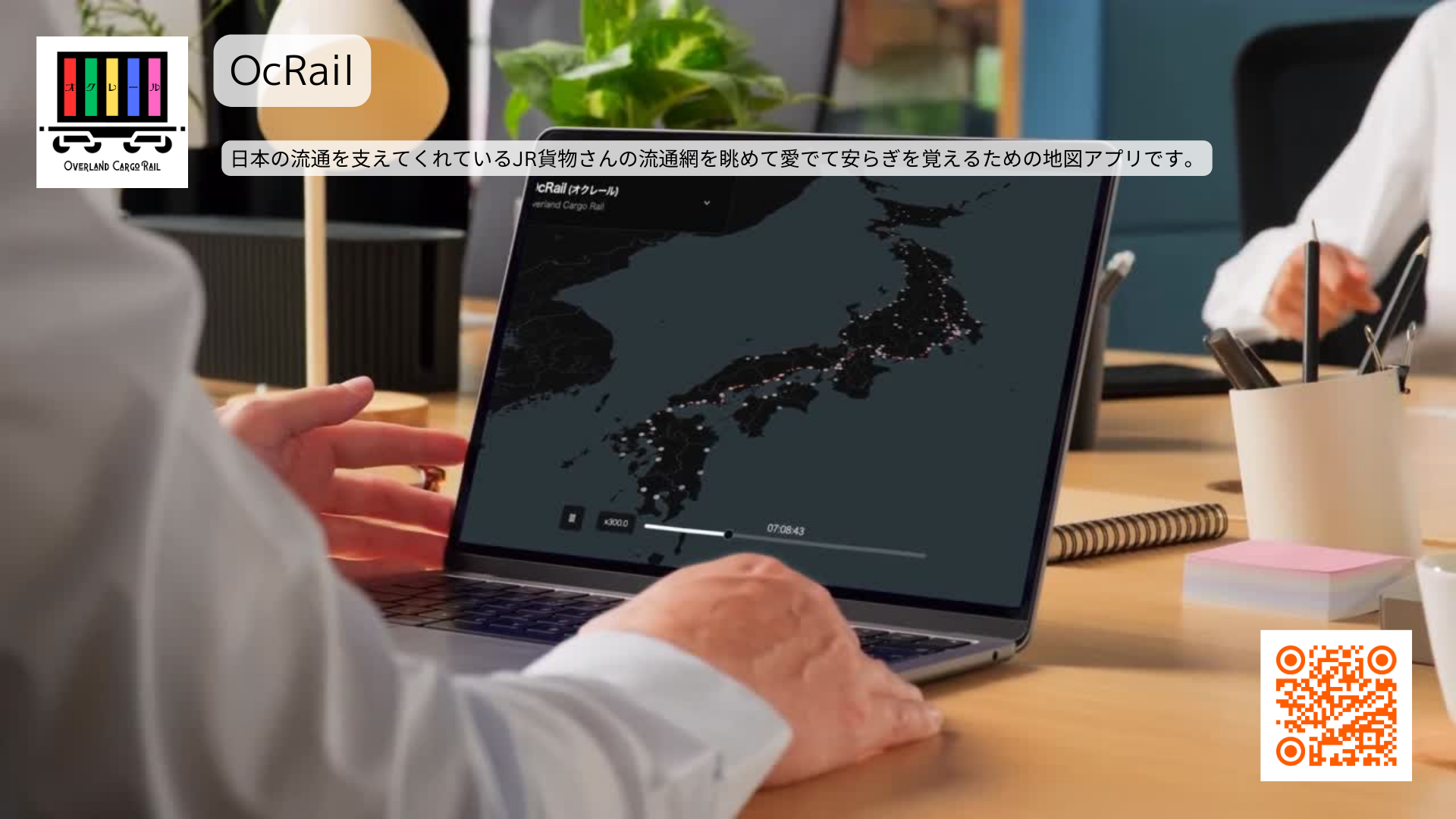
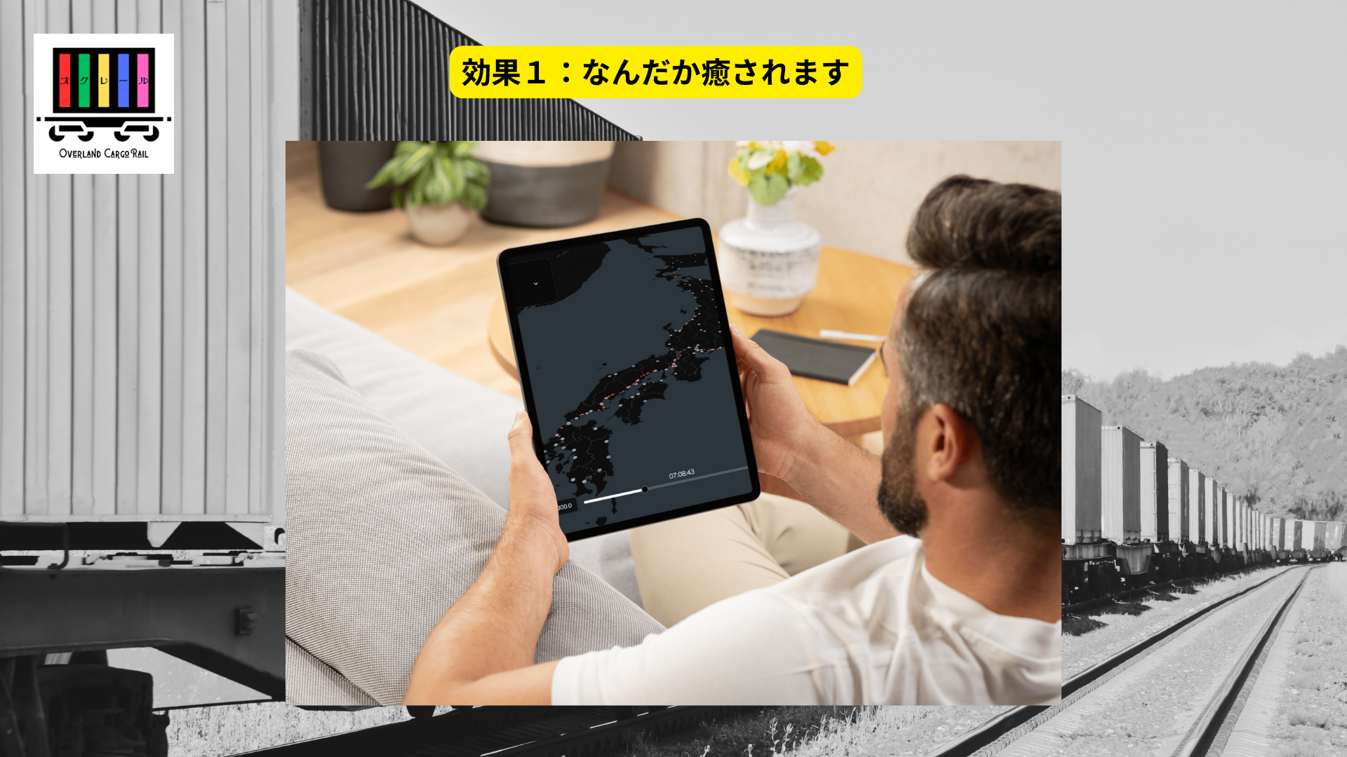
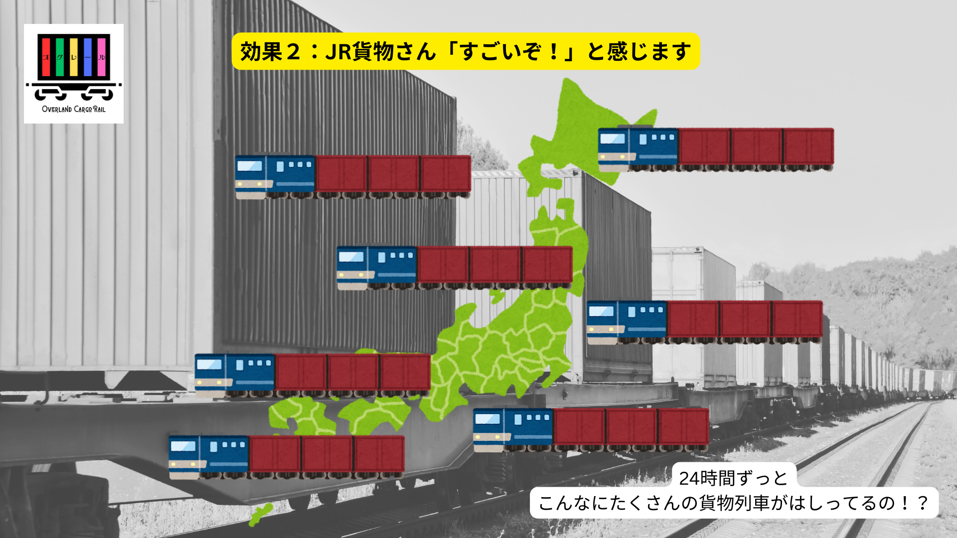
Download
□web app
https://ocrail.tomap.app/
This web service overlays open data–based traffic accessibility indices with transit data and the PLATEAU 3D city model for comprehensive visualization. It supports municipal planning, reaffirms local value, and aids in emergency decisions such as evacuation and transit alternatives.
Download
□web app
https://traffic.quantum-rabbit.net/
Annelida reinterprets public transportation as an ecosystem, visualizing transit deserts and network diversity. Using GTFS data, it integrates spatial, temporal, and attribute data for accessibility assessments. Inspired by earthworm ecosystems, it provides policymakers with insights while fostering a shared language in communities to enhance understanding and consensus on transit policies.
Download
□web app
https://mimizu.onrender.com/
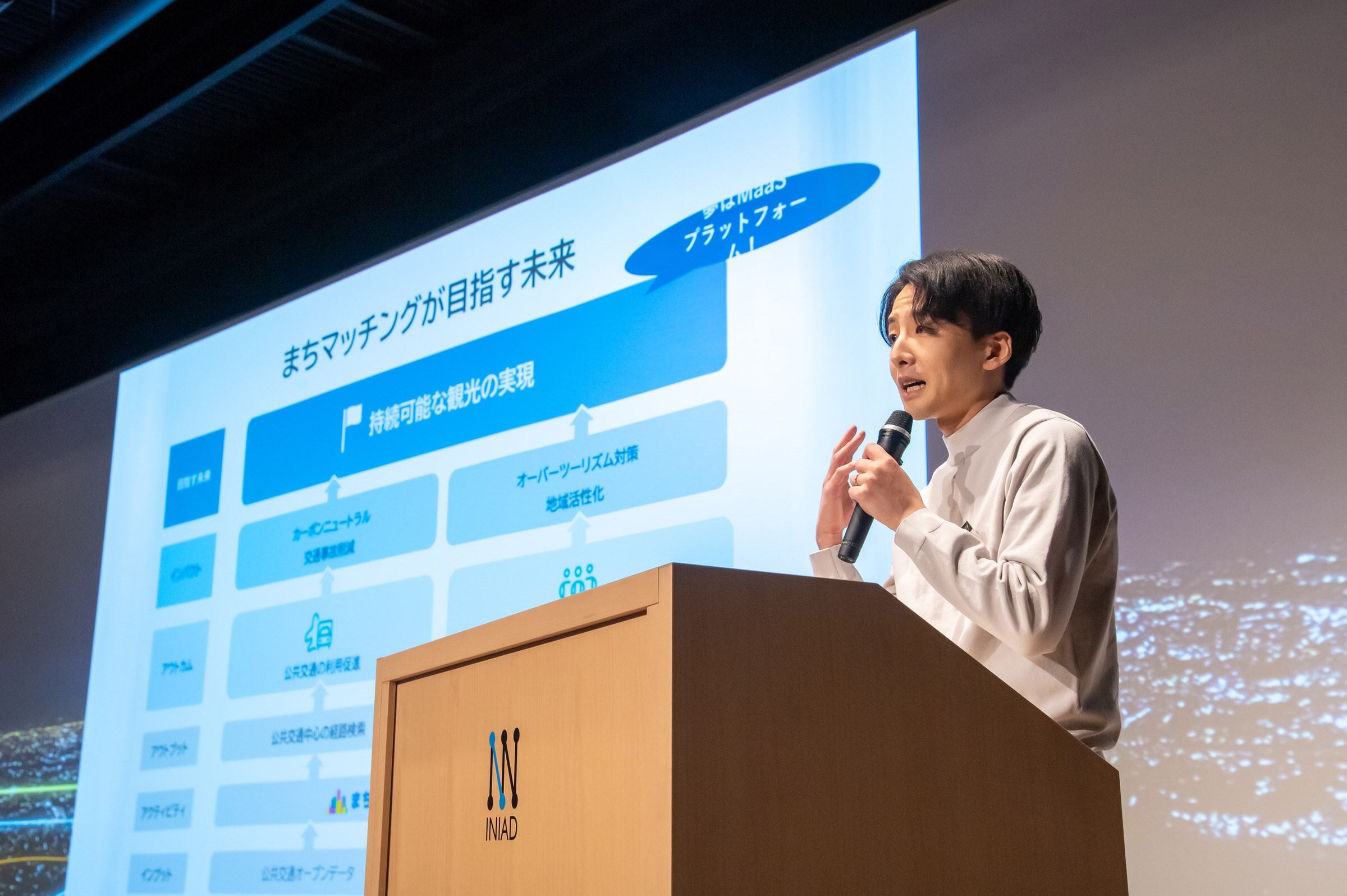
"Machi Matching" is a travel app that connects users with communities using public transport. It offers random, theme-based destinations and local info. Multi-modal travel options ensure door-to-door routes, aiming to distribute tourists, revitalize regions, and promote carbon neutrality. Discover new charms with easy UI and random suggestions.
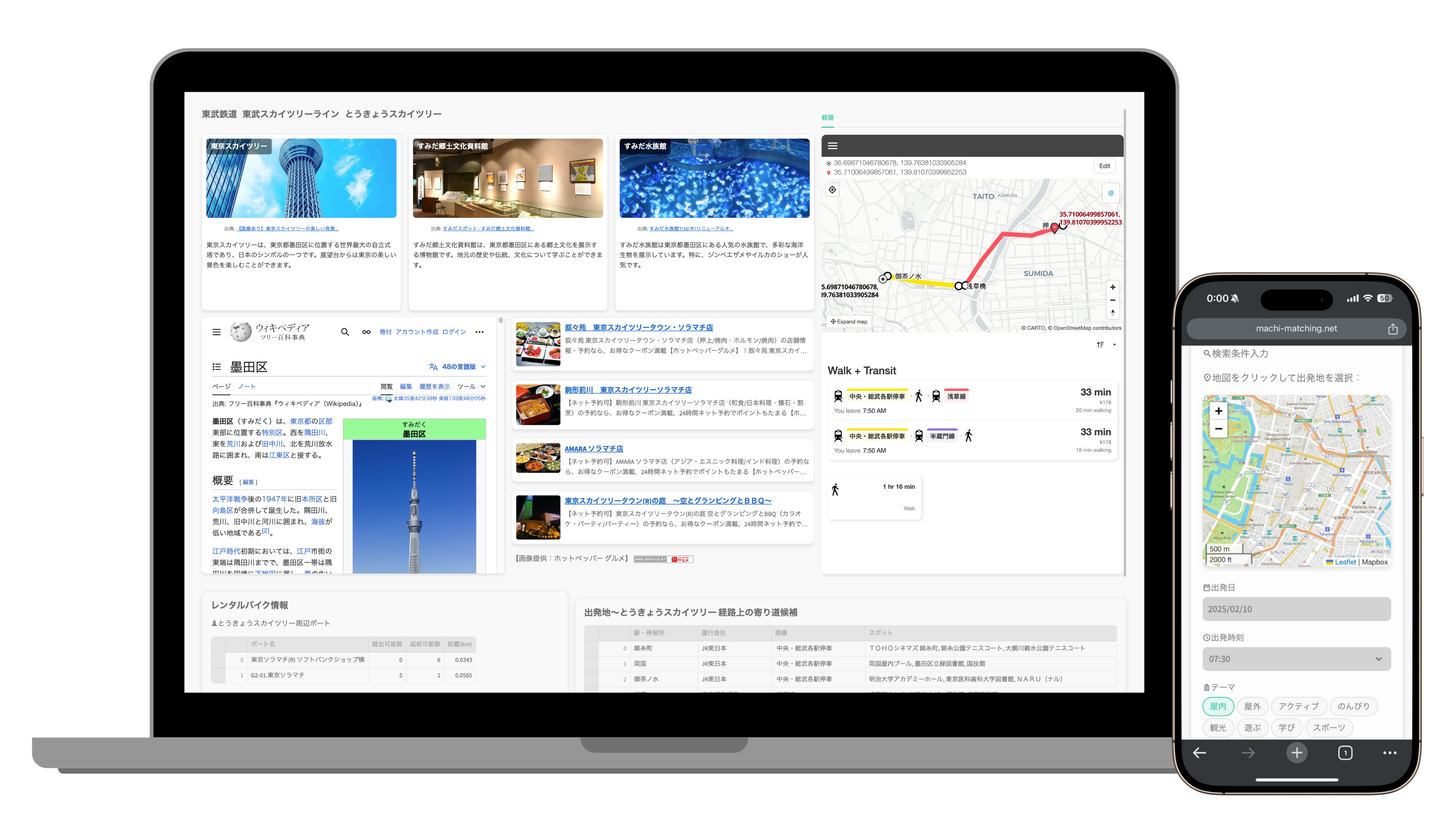
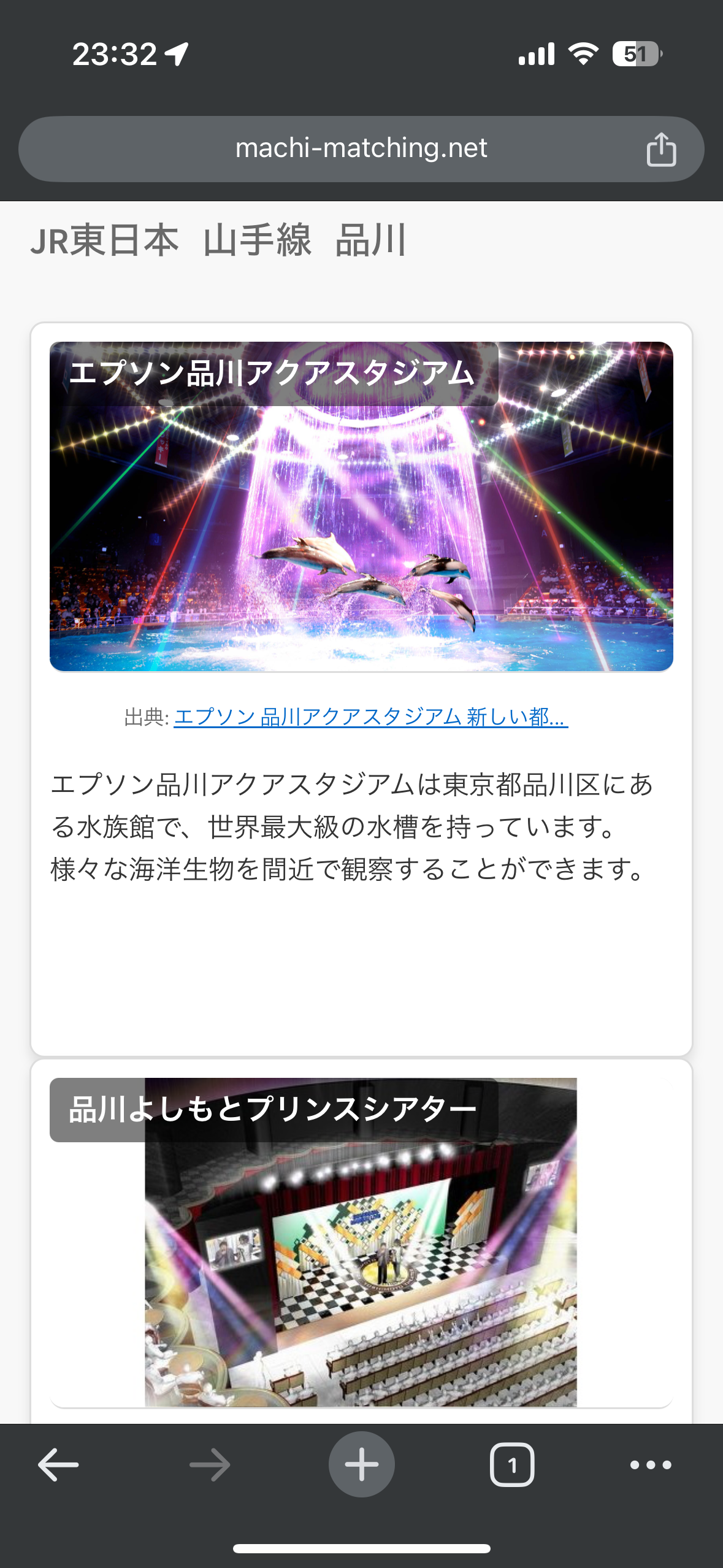
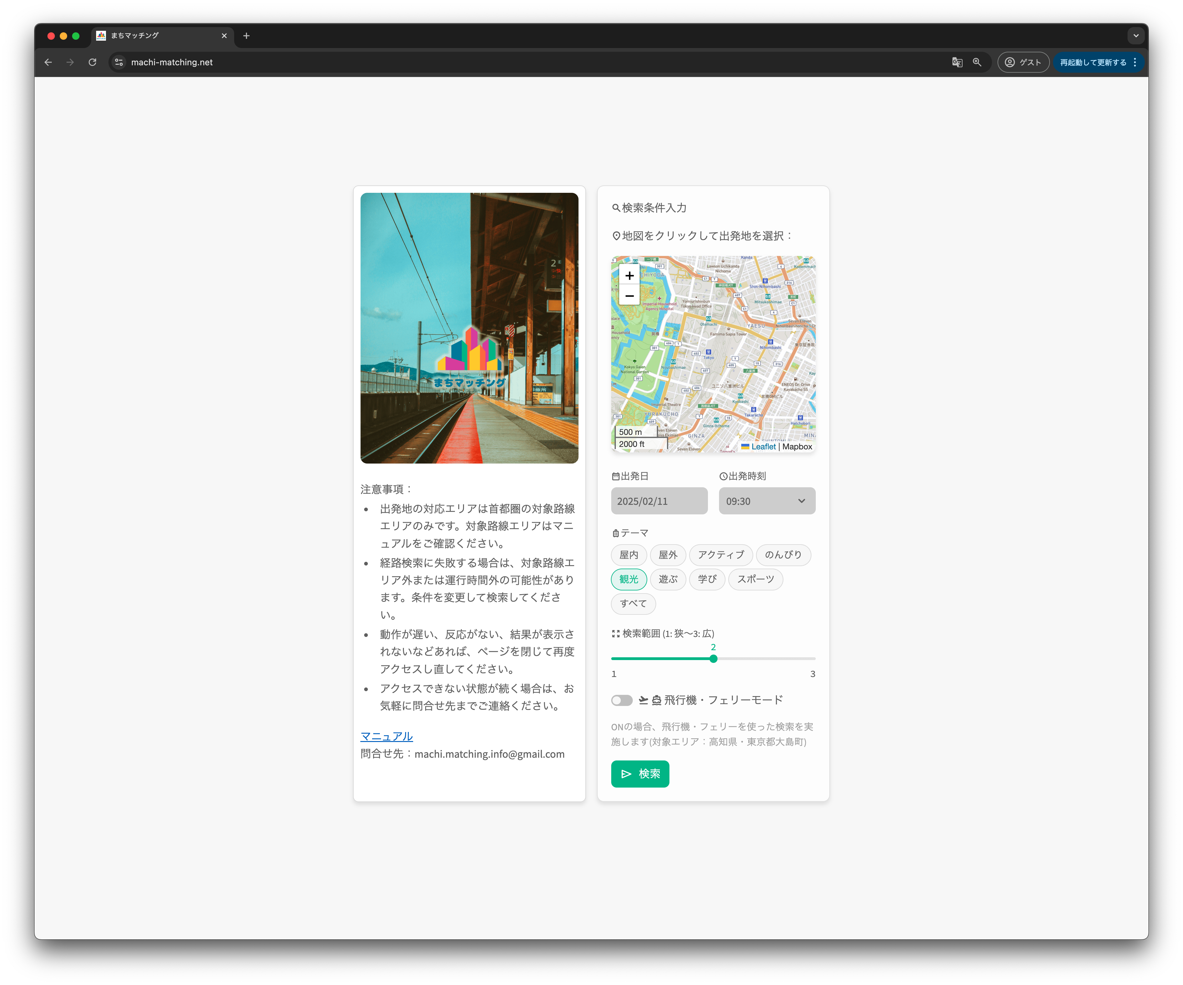
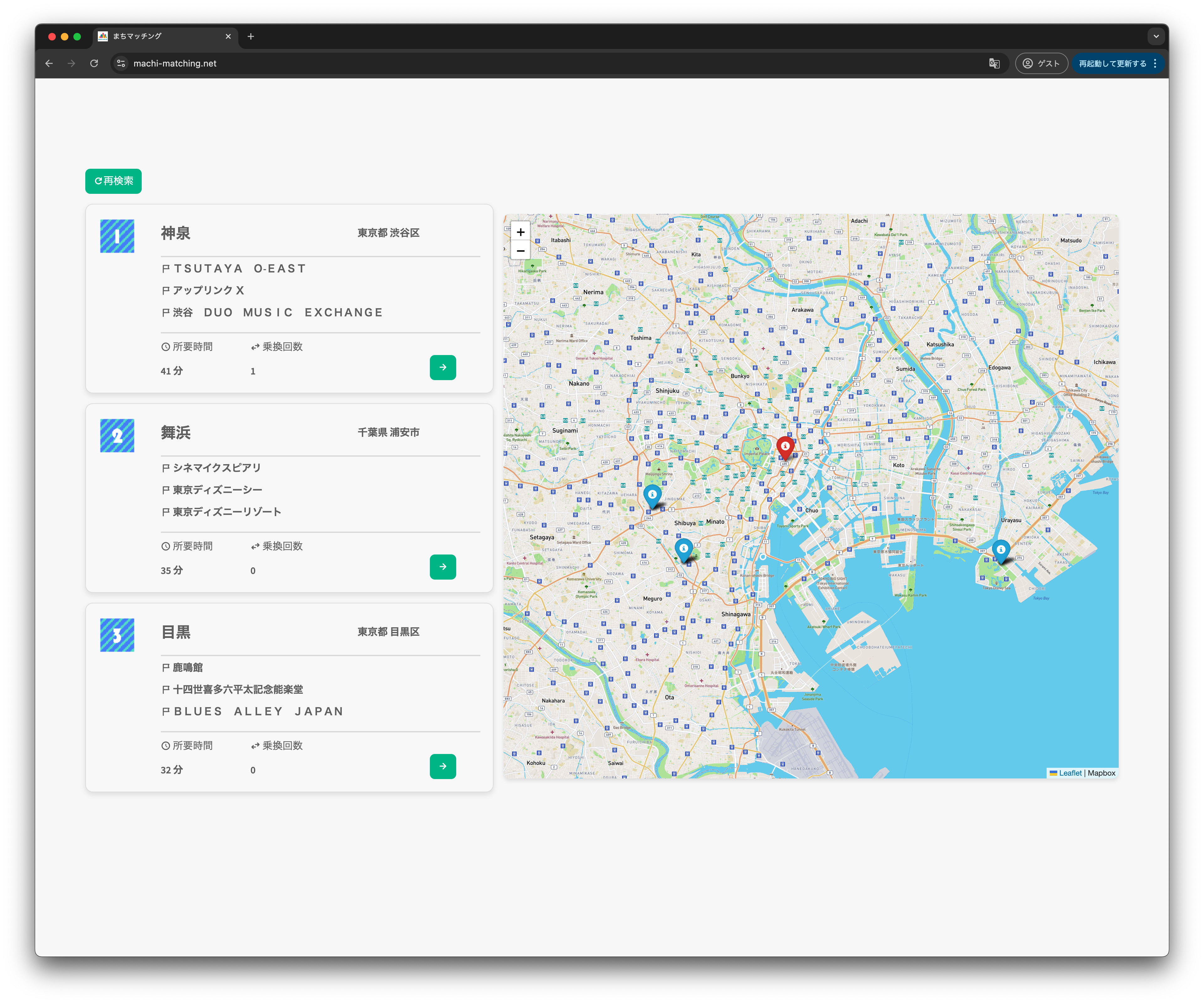
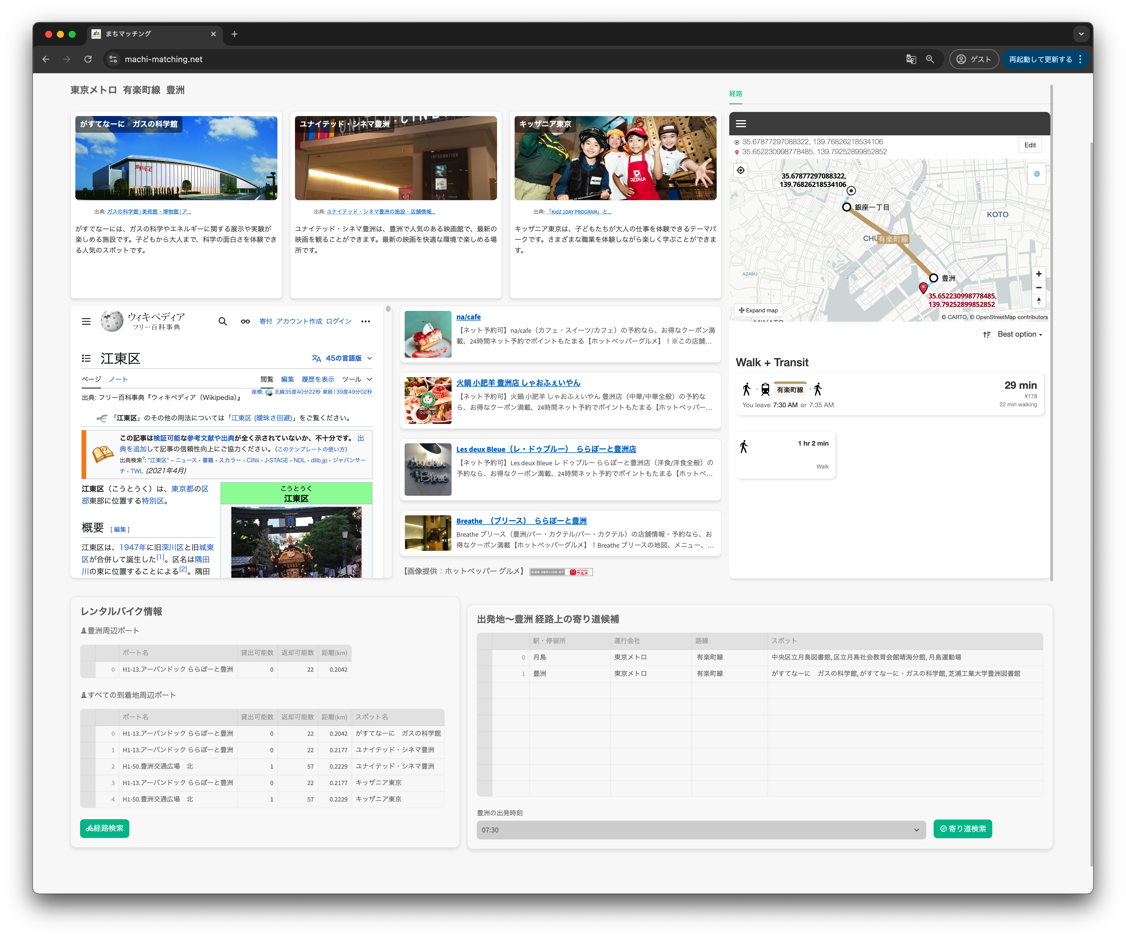
Download
□web app
https://machi-matching.net/
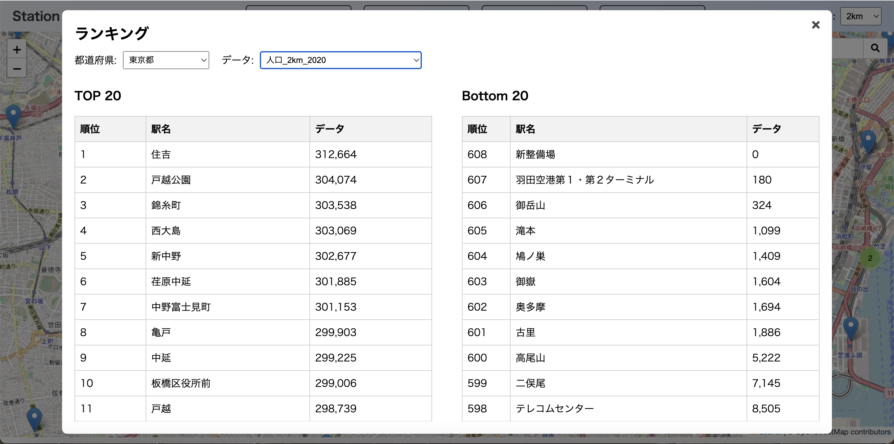
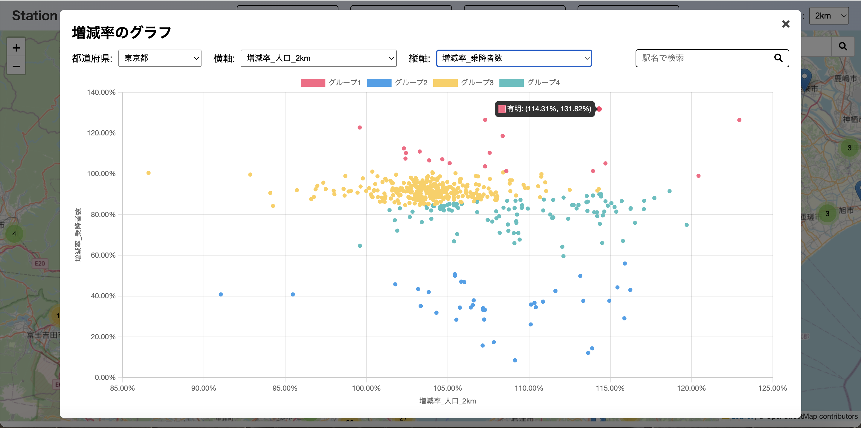
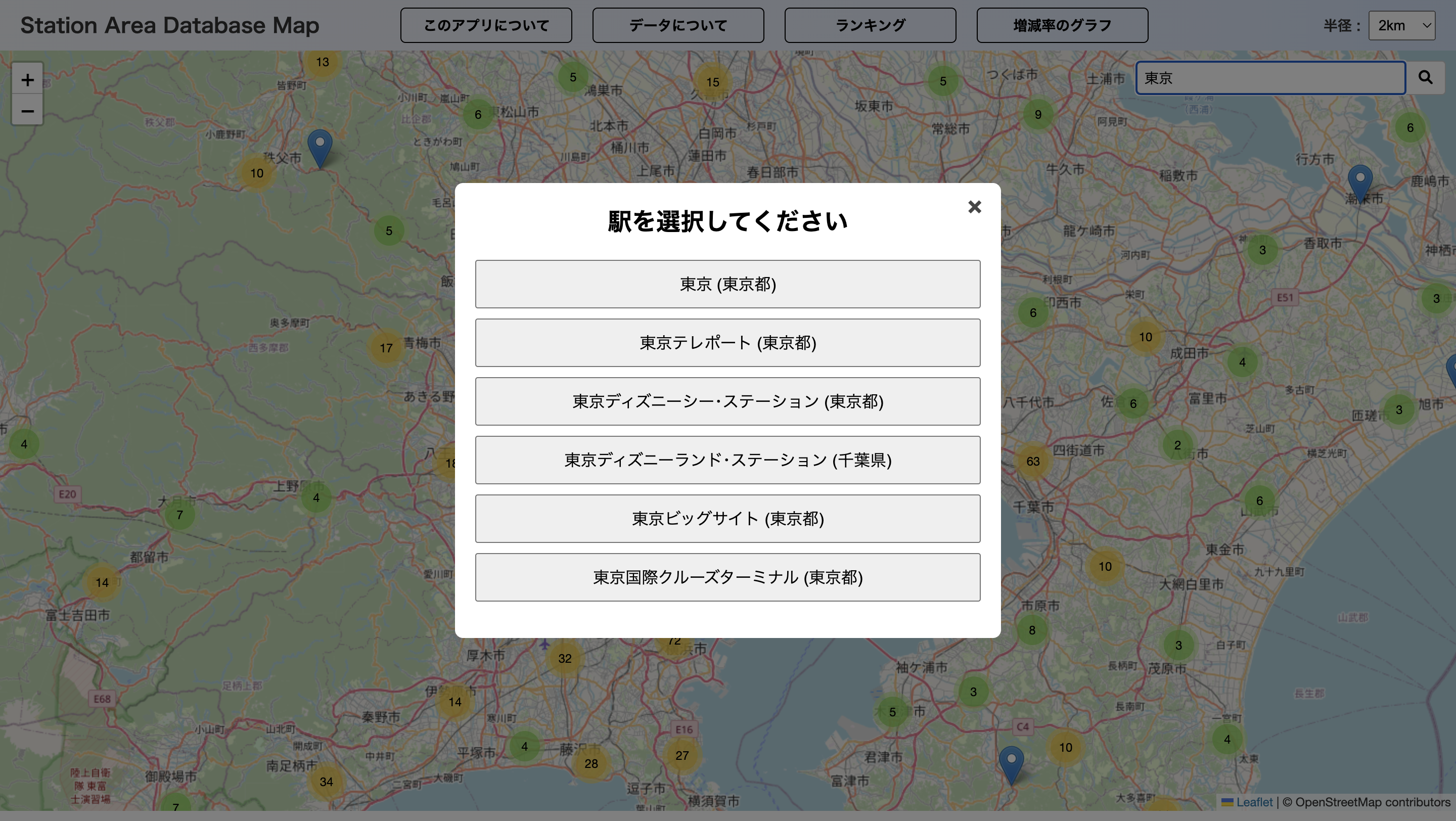
This web app visualizes open data for each station in Japan—number of passengers, population, land price, bus stops, businesses, and employees—by radius. Features include: one-click annual data display, top/bottom 20 rankings by prefecture, and two-axis (including growth/decline rates) scatter plots with four-group clustering for easy, data-driven decision-making.
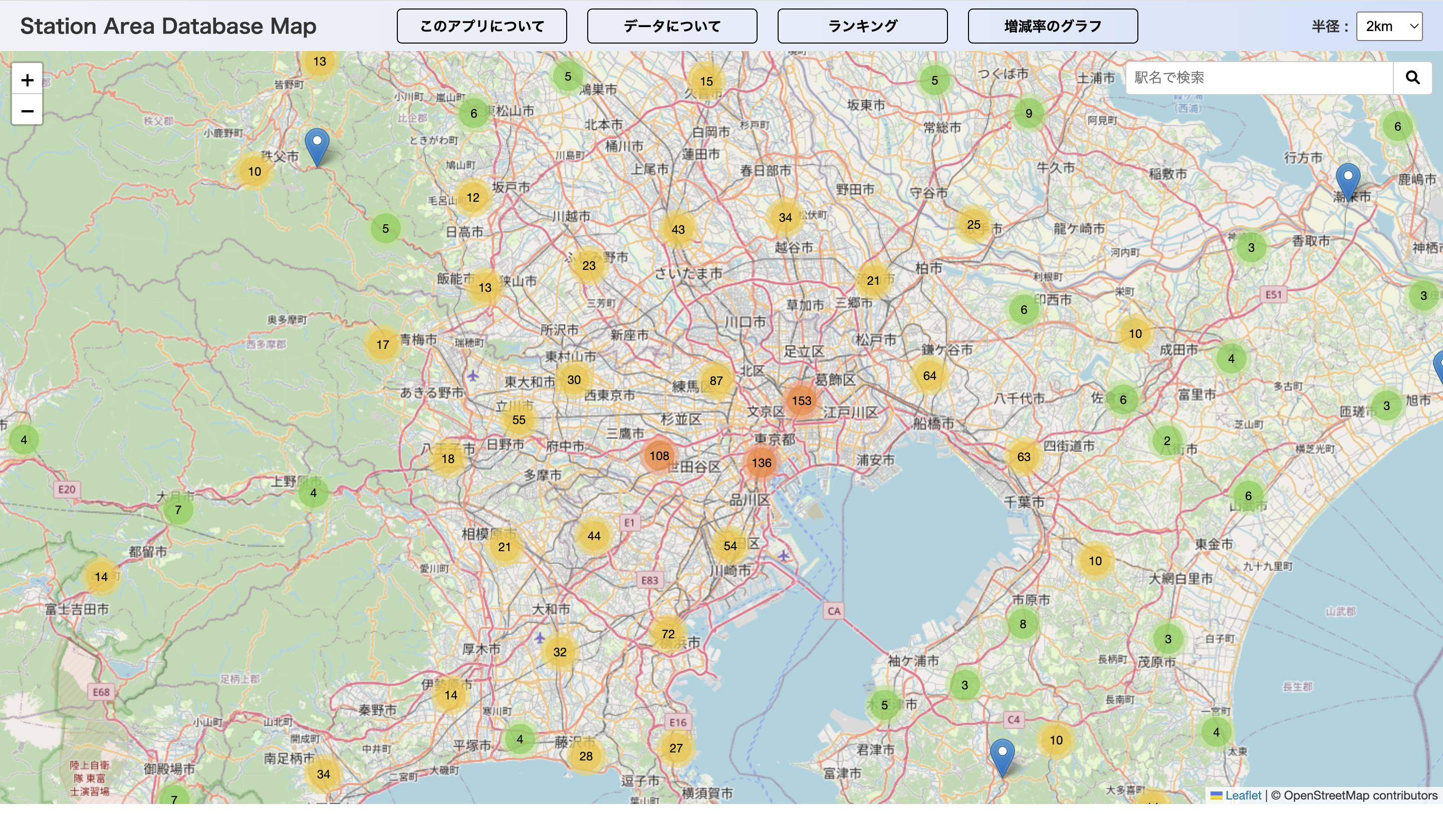
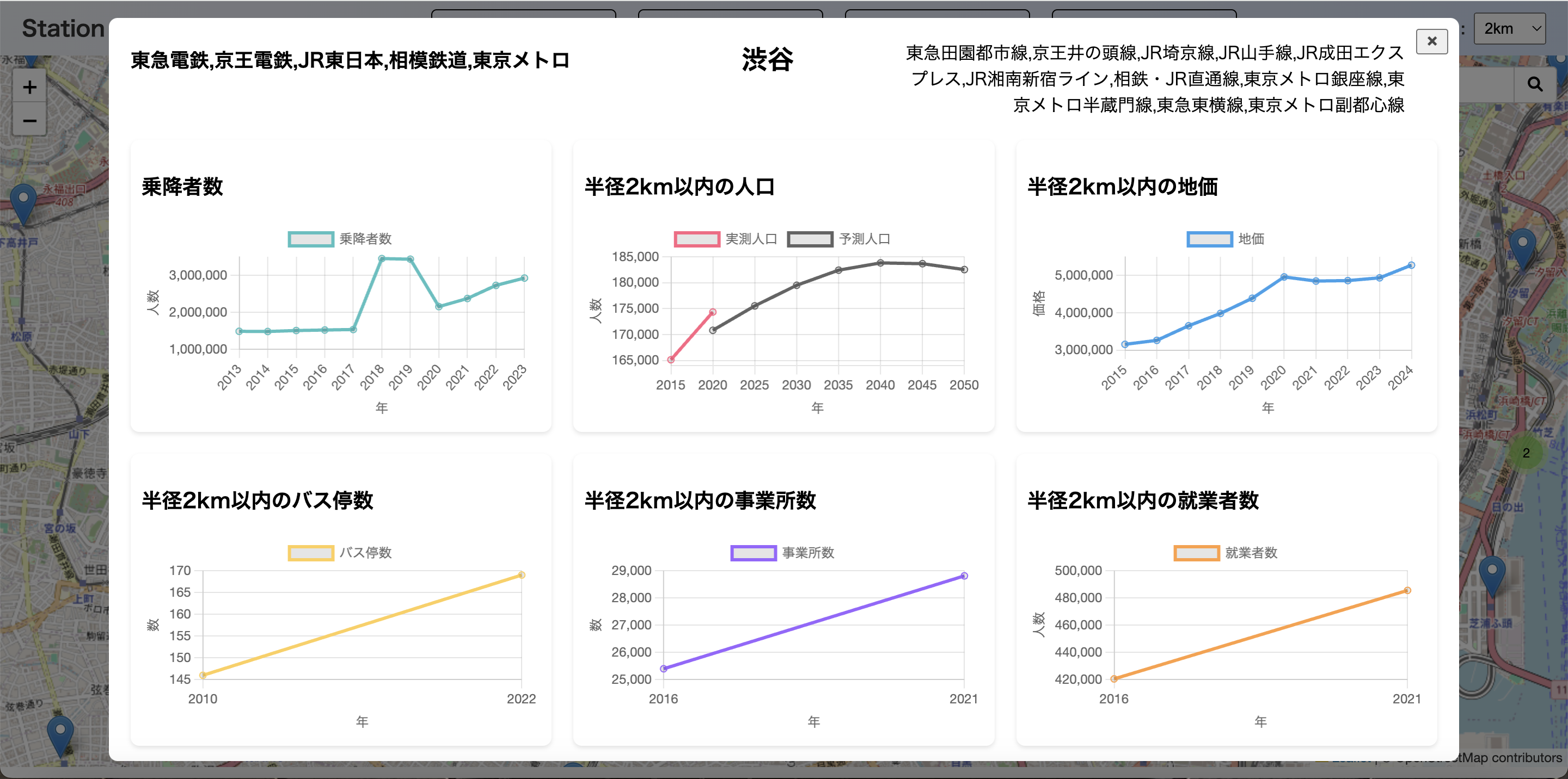
Download
□web app
https://station-area-database-map-e3cf888068c6.herokuapp.com/
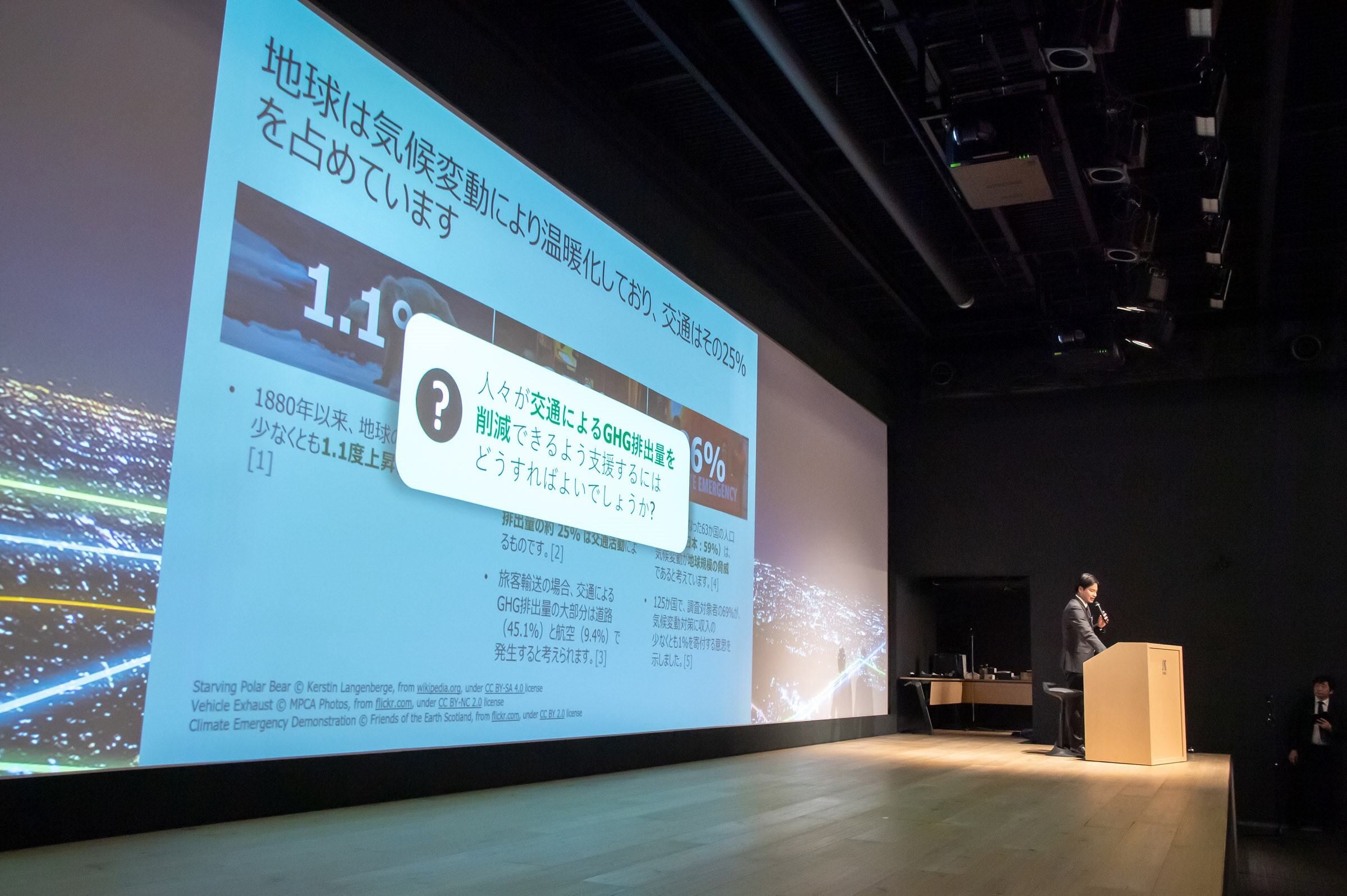
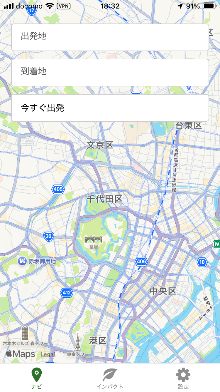
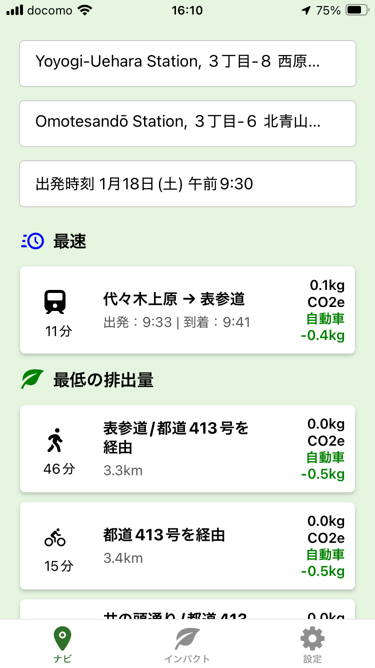
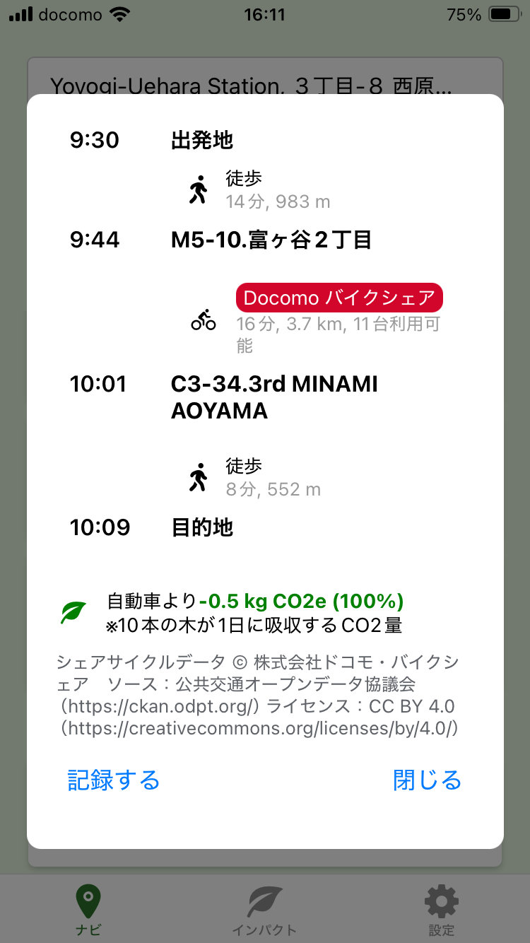
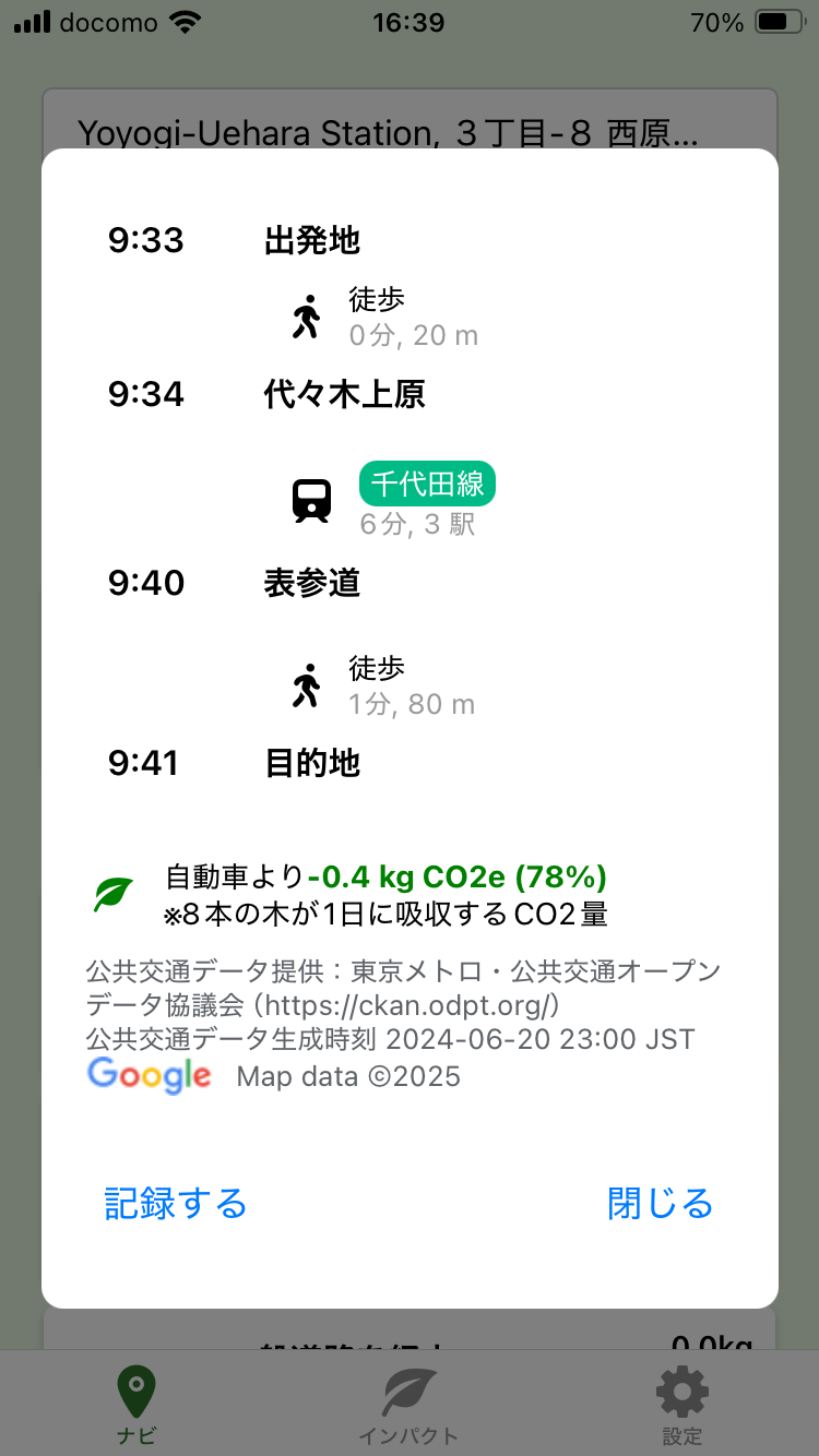
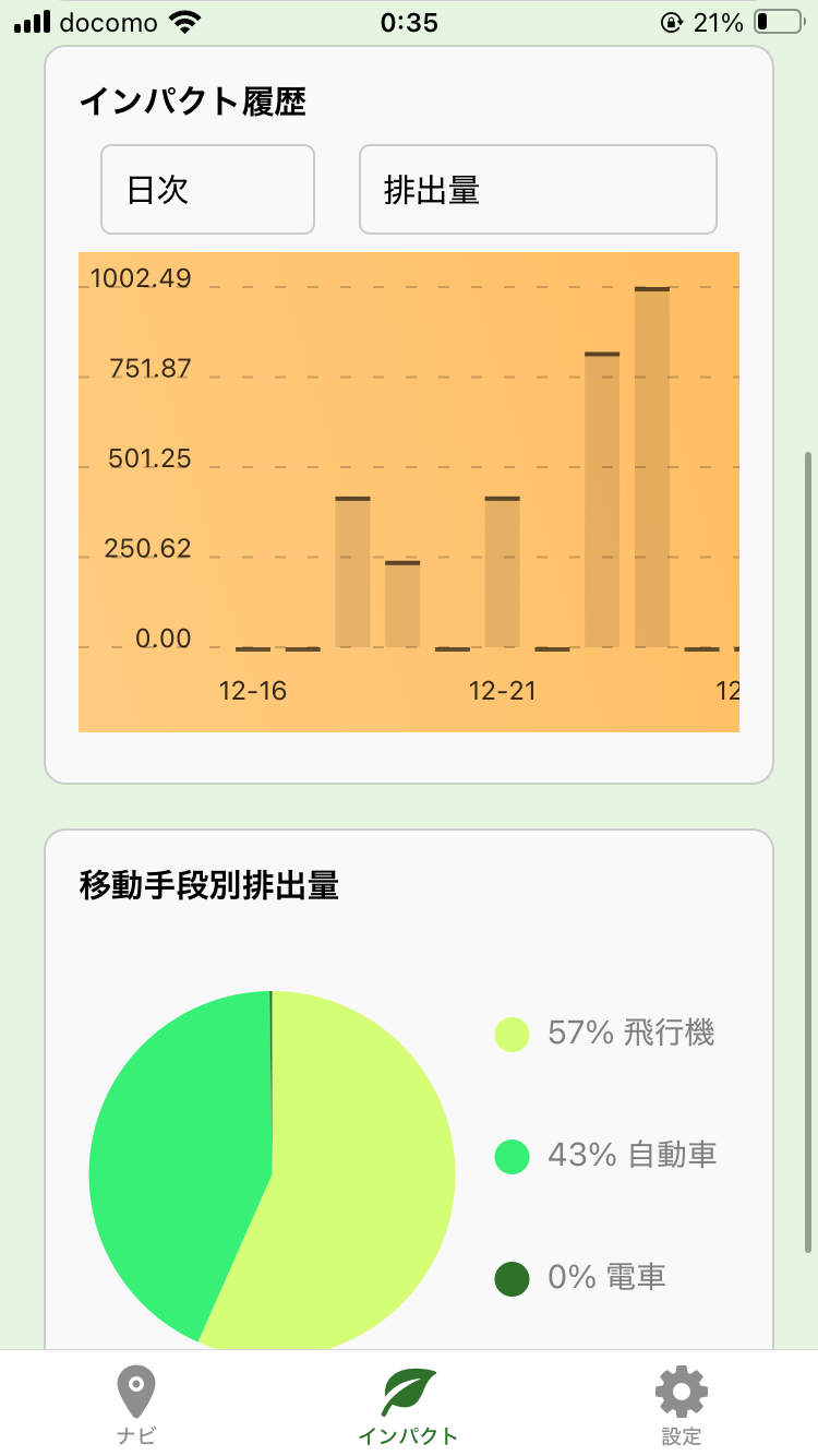
LeafLane is an iOS navigation app that estimates and presents greenhouse gas (GHG) emissions for available transportation routes. Users can select their travel mode, and the app provides detailed GHG reports. By integrating data from various transport sources, LeafLane offers a seamless navigation experience, promoting environmentally conscious travel decisions.
Download
□iOS app
https://apps.apple.com/jp/app/leaflane/id6739495304